|
Water Under the Desert |
||||
|
Death Valley California ..
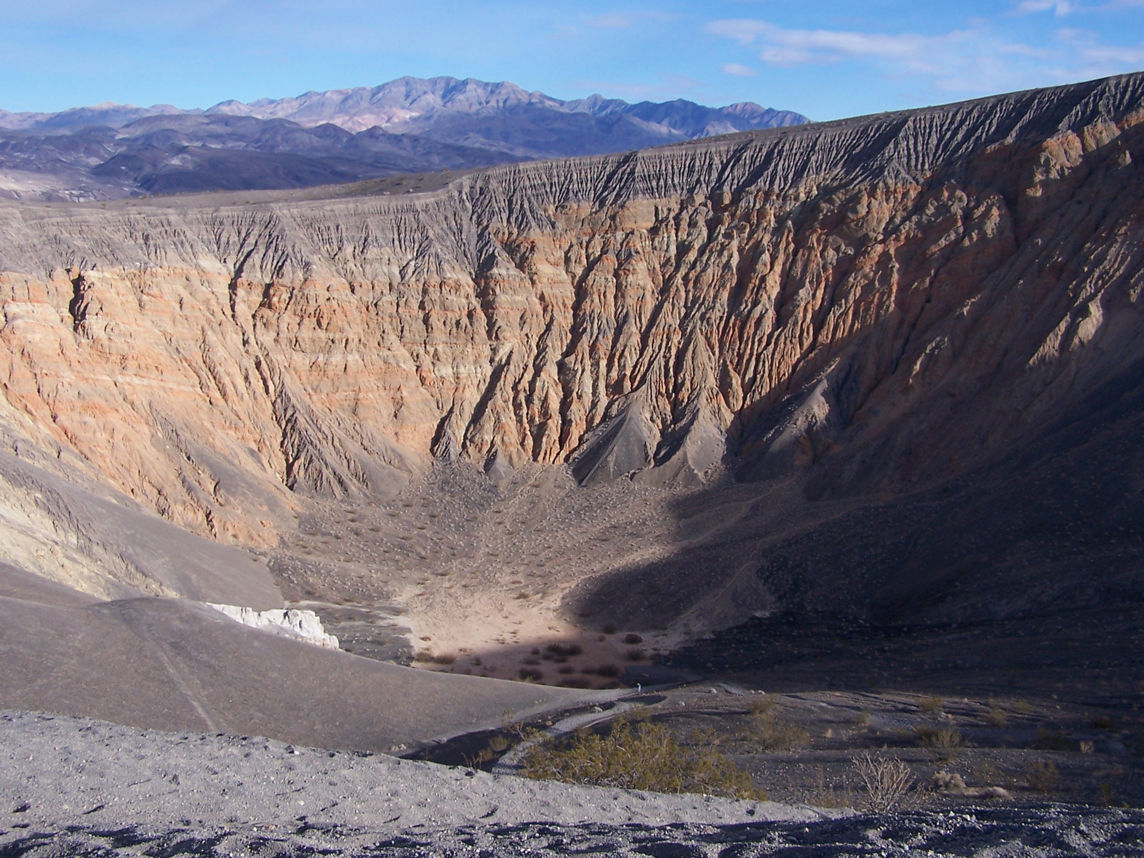
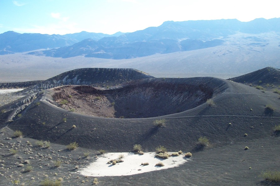
Because this event is so dramatic, it seems a good place to begin our hunt for underground waterways, lakes and seas. There is a rumor of a huge underwater naval base at Hawthorne, Nevada and we will lead into that but first let us see if we can find any large underground areas of water and see where it leads us. Like in the movie Dune... the desert hides many secrets.. The image above is the Ubehebe crater system and is located in the northern part of California's Death Valley National Park. The system contains several volcanic craters, cinder cones and ash hills, all relics from an explosive steam eruption about 2,000 years ago, when rising magma met an underground lake. Ubehebe is by far the largest crater, 2,400 feet in diameter and 500 feet deep. 2000 years ago, about the time of Christ, so this is 'recent history' for the intent of this search.
One of the things we will also be looking for is evidense that the Earth is porous... like a sponge... and many huge reservoirs of water exist all over the world... But lets start with Death Valley in California... the hottest driest spot on the planet.... Well as the above incident shows us there once was a large underground lake that mixed with molten magma and caused this steam eruption...
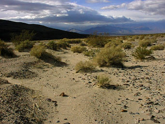
The Amargosa River is the only river currently flowing into Death Valley, and its flow is mostly underground. During ice ages, however, the stream flows just like a real river, and it is aided in its lake-making project by the Mojave River which is also usually dry during this current climate. During an ice age the Mojave comes north across several low barriers, fills several dry lakes to overflowing, like the Soda, the Silver, and the Silurian dry lakes, finds Salt Creek, and through it joins the Amargosa before it reaches Death Valley... ...But, the northern drainage, coming through Oasis Valley, and hence the Amargosa River, had some running water in it that disappeared underground just south of Beatty. There the bedrock that was shallower before, in, and through Beatty took a dive, and deep sediment layers became the bed of the river, allowing the water to move down and continue its journey south below the surface. The Amargosa River below Beatty has entered the Amargosa Desert, the Amargosa Valley. In subsequent pages, I will show photographs of these areas, but I did not venture far from the highway or an occasional graded dirt road for several good reasons. The drainage in Oasis Valley that continues north and then west, as well as the aforementioned tributary coming in to the river from the east just above Beatty, can be followed on jeep trails. But they cannot be pursued too far, because they either meet the Nellis Air Force Range or the Nevada Test Site boundaries, making both off limits to the public from those points on. But advice from someone who knows the area is that even with a jeep he wouldn't make book on being able to drive these drainage all the way to those boundaries. And being confined to a sedan as I was, I did not venture far off the paved road system. Caution is the better part of safety.... ...When I arrived here in search of
the little river
that could, and sometimes did, a tourist from
Georgia asked me what I was
taking pictures of. I said, "the Amargosa
River." He laughed.
He thought I was lying. This is what we were
looking at:
Obviously, it was a river.
Flowing northward
into Death Valley from the south, at this
point. It was not only
a river, but it was the river, the Amargosa River.
SOURCE: http://www.thoughtsandplaces.org/AmargosaR/AmRiver1.html Read the whole article if your
interested in more,
but all we need right now is to show where the
underground water lies...
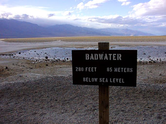
One image I just had to include though is this sign
at Badwater, Death
Valley..
|
||||
|
Lake Manly, Death Valley ..
As Lake Manly evaporated to the surface of Death Valley, it left a remarkable legacy. Under the surface of Death Valley is one of the world's largest underground reservoirs (aquifers). Being fed by the Amargosa River and Salt Creek, this aquifer is barely visible above ground at Badwater, the lowest point in the valley (282 feet below sea level). In 2005, large amounts of flooding resulted in Lake Manly's reappearing on a large scale[2]. Over a hundred square miles were covered by the lake, allowing some tourists and park rangers to become probably the only humans to canoe across the valley. The lake was about two feet at its deepest point. As a result, it evaporated quickly, leaving behind a mud-salt mixture. SOURCE: Wikipedia Lake Manly
Photo: Nevada Fish & Wildlife Office |
||||
|
Devil's Hole, Death Valley ..
Life in Death
Valley
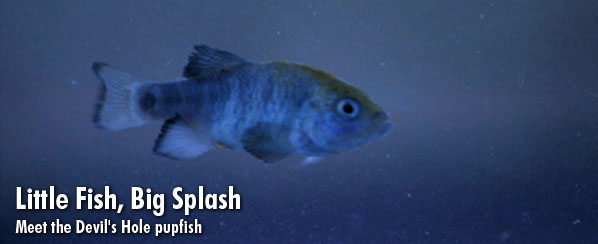
In the remote area of Death Valley National Park known as Devil's Hole, six men suit up for a long day of desert exploration. But these explorers are swapping their dusty hiking boots and water bottles for neoprene wet suits and oxygen tanks. As NATURE's LIFE IN DEATH VALLEY reveals, the men are part of a specialized team of divers who assemble in this 40-acre pocket of Death Valley four times a year to monitor the population of the park's most surprising desert creature: the critically endangered Devil's Hole pupfish . Death Valley may seem an unlikely habitat for a fish, but this tiny species has managed to thrive here for thousands of years despite epic changes in its environment. When summer temperatures spike to 120 degrees, it's difficult to imagine Death Valley in an ice age. But twenty thousand years ago, the valley rested beneath a vast lake system where the ice-age ancestors of these pupfish swam. As the climate warmed, the lake dried and formed separate pools, and the fish that were once part of the same parent population began to develop unique characteristics in response to their individual environments, eventually evolving into several distinct species of pupfish. But it's the fragile Devil's Hole species that has made the biggest waves throughout history, primarily due to the place it calls home. Located in southern Nevada, the "hole" itself is a fissure in the earth's surface that split open 60,000 years ago to reveal an astonishing underworld: a water-filled limestone cavern. Ironically, beneath the hottest, driest place in the Western Hemisphere stretches a vast aquifer system. The opening at Devil's Hole is one of the few places in Death Valley where the water from this system meets the surface. 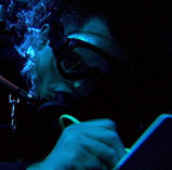
Diver taking count of fish "This is the only place on the planet where this fish exists naturally," says Zane Marshall, head diver for the Devil's Hole Pupfish Recovery Team. "Scientists have estimated that it has been in isolation here in excess of 25,000 years." Marshall's team is part of a larger recovery effort that includes representatives from the National Park Service, the Department of Fish and Wildlife, and Nevada's Division of Conservation. "This pupfish is the most restricted vertebrate species in the world," says Marshall. It was that exact notion that prompted President Harry Truman, in 1952, to protect the unique pupfish and its habitat by designating Devil's Hole a disjunct part of Death Valley National Monument. For nearly two decades, the fish enjoyed a protected haven. But by the late 1960s, development and nearby farming beyond the boundaries of the monument began to take a toll on the water levels in Devil's Hole. As the pupfish do most of their feeding and spawning on an algae-carpeted limestone shelf just a few inches below the surface, a small drop in the water level was all it took to bring the fish to the brink of extinction. What ensued was a bitter contest over water rights that pitted developers against conservationists and the federal government against a corporate farm. In the end, the fish reigned victorious. In 1976, the U.S. Supreme Court issued a landmark ruling that protected not only the fish but also their fragile habitat by specifically stating that water levels in Devil's Hole must remain high enough to completely cover the spawning shelf. As a result of the ruling, development was halted, and the fish became one of the very first species to be protected under the Endangered Species Act. Since then, Devil's Hole has been cordoned off from park visitors by a chain-link fence that runs the perimeter of the hole. Only members of the recovery team are permitted access in order to perform quarterly counts of the fish. From 100 feet beneath the surface, the team works their way up in pairs, counting and measuring every fish they see. This provides them with an index of how the population is doing. Despite 30 years of federal protection, recent counts suggest grim news: the fish's population is once again plummeting. Linda Manning, a biologist for Death Valley National Park has been working closely with the Pupfish Recovery Team. "Right now we are very concerned because we recently had the lowest count in 32 years -- only 123 fish," she reports. This time, however, the reasons for their decline are not so clear. Due to its protected status, study of Devil's Hole has been extremely restricted. "We don't yet understand everything that is going on in this system," says Manning. "It's a real puzzle. You wonder what the dynamics are. What's impacting the fish? How are they making it? We're just starting to get a handle on it, but there's just still so much more to know." What they do know is that it is a harsh environment for a fish. The water temperature is 93 degrees Fahrenheit, food sources are extremely limited, and sunlight only hits the surface of the spawning shelf four months out of the year. "It's pretty amazing that they've actually survived for thousands of years in this environment," says Manning. "I just hope they can continue." In addition to conducting quarterly counts of the fish, the Park Service has installed monitoring wells near Devil's Hole to keep an eye on the water levels, which have been dropping gradually over the past 14 years. Development and groundwater pumping in nearby Pahrump, Nevada, has long been suspected of affecting the water level in Devil's Hole, though many Pahrump officials deny the allegations. If the team doesn't find a solution soon, the devastating effects may be far-reaching. "We definitely believe the pupfish are an indicator for the health of this system," offers Manning. "When you start poking holes in the fabric of an ecosystem, over time it's going to tear, and the impacts will be felt by everyone." Before that happens, the team will continue to do all they can to ensure the Devil's Hole pupfish keep hold of their well-earned reputation as resilient survivors. SOURCE: PBS NATURE |
||||
|
Devil's Hole Pupfish ..
In May of 2005, nine pupfish were moved from the hole and a Federal Hatchery to both a Las Vegas Strip casino aquarium and another Federal Hatchery in hopes of augmenting the population. In November 2005, divers counted just 84 individuals in the Devil's Hole population, the same as the spring population, despite observations of egg-laying and baby fish during the summer. As many as 80 fish - one third of the population was estimated to have been destroyed during the summer of 2004 when a flash flood pushed a quantity of scientific equipment into the hole; later about 60 cubic feet (1.7 m³) of debris, washed into the cave by floods, was removed. Reasons for the continued decline remain unknown, although one possibility is to add some artificial lighting to encourage growth of the algae that the pupfish eat. Two males from the hole and two females from a hatchery at Hoover Dam were moved to the Shark Reef aquarium and exhibit at the Mandalay Bay hotel-casino. Another five younger pupfish were moved to the Willow Beach National Fish Hatchery in Arizona in order to establish the pupfish in aquaria. 36 adults are believed to still reside in the hole after the moves. In 2007 there were between 38 and 42 fish left in Devil's Hole. SOURCE: Wikipedia |
||||
|
Area 19 Nevada Test Site ..
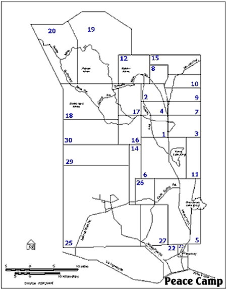
One of the Nuclear Bomb test sites in Nevada, the map above shows the locations of the various areas designated by number. (Area 51 would be to the right of this map) Shundahai Network has an excellent website with details about these areas... for our purpose we are only interested in Area 19... and why it was not used. Area 19 Key Excerpts: ...This area, within the Nuclear Test Zone, occupies 388 km2 (150 mi2) in the northwest corner of the NTS. ...Area 19 in the northwest coner of the test site was originally developed as a suitable location for higher yield underground nuclear test (over several hundred kilotons). No atmospheric nuclear tests were conducted in Area 19... ...From the mid-1960s through 1992, a total of 36 underground nuclear tests were conducted.... ...The geology of Pahute Mesa makes it possible to test devices at much greater depths than in Yucca Flat (down to more than 13,700 meters (4500 feet))... ...It was the recollection of a former worker at the NTS that "an awful lot of drilling" was done in Area 19, but relatively few nuclear blasts. He says there was a story released that the drillers hit an underground lake, as a result the NTS was not able to fully utilize the area. SIDE NOTE: NASA's Apollo astronauts use Test Site craters to prepare for Moon surface. Because the "Schooner" and "Sedan" craters at the Nevada Test Site had features similar to the topography of Moon craters, astronauts used them to train for their missions. Astronauts for Apollo 14 exercised at Schooner crater, and visited Sedan crater in November 1970. Apollo 16 astronauts visited the Schooner crater in November 1970, and exercised there in October 971. Apollo 17 astronauts conducted exercises at Schooner and on Buckboard Mesa in August 1972. SOURCE: Shundahai Network Area 19 |
||||
| Excerpt from
Dreamland Resort...
Area 19 - What is it and why should we care? by Tom Mahood "Another rumor comes from a former worker at the NTS. It was his recollection that "an awful lot of drilling" was done in Area 19, but relatively few nuclear blasts. He says there was a story released that the drillers hit an underground lake, and as a result the NTS was not able to fully utilize the area. This seems to tie in with the fact that while there were a goodly amount of blasts done in Area 20, and some in the southerly part of Area 19, the records show very few in the heart of Area 19. The worker did seem to think there was something '"odd" about Area 19." - by Tom Mahood |
||||
| FAIR USE NOTICE: This page contains copyrighted material the use of which has not been specifically authorized by the copyright owner. Pegasus Research Consortium distributes this material without profit to those who have expressed a prior interest in receiving the included information for research and educational purposes. We believe this constitutes a fair use of any such copyrighted material as provided for in 17 U.S.C § 107. If you wish to use copyrighted material from this site for purposes of your own that go beyond fair use, you must obtain permission from the copyright owner. | ||||
|
|
