|
|
|||
|
Antarctica has Warm Inner Lakes in Bunger Hills Area! 66° 17' 0" S, 100° 47' 0" E .. |
|||
|
66° 17' 0" S, 100° 47' 0" E ..
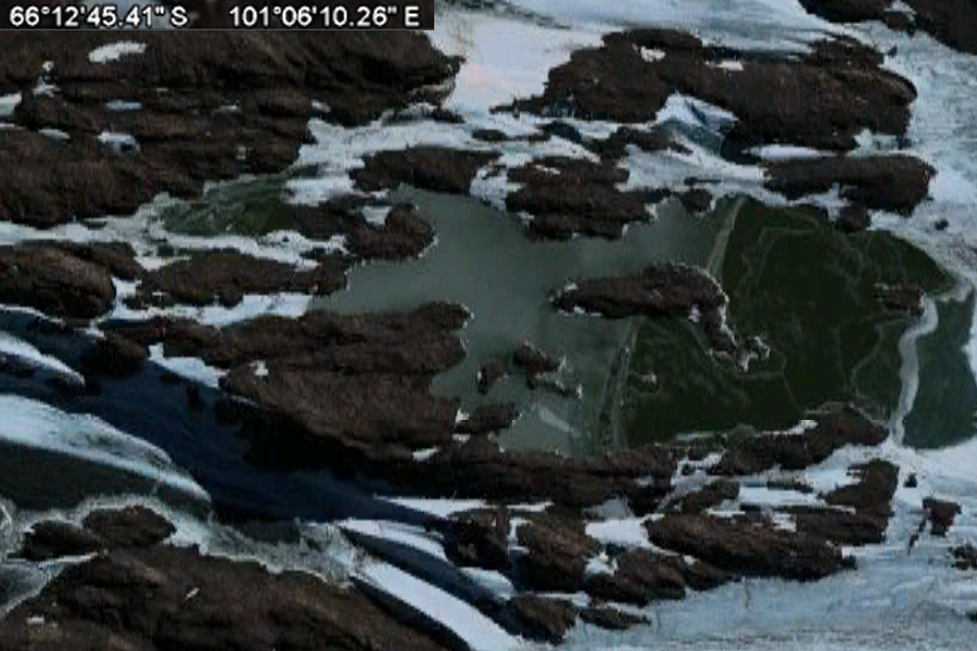
66°12'45.41"S 101°06'10.26"E Bunger-Oase
Die Bunger-Oase ist eine weitgehend eisfreies Gebiet im Wilkesland, etwa sechs Kilometer von der Küste der Ostantarktis entfernt. Mit ihrer 952 km² großen Fläche ist sie die größte der ostantarktischen Oasen und umgeben von Gletschern. Sie wird im Westen begrenzt durch das Denann/Scott-Gletschersystem, im Süden und Nordosten von kleineren Gletschern und im Südosten durch den antarktischen Eisschild. Nach Norden ist sie durch das Shackleton-Schelfeis mit einer Breite von 50 bis 70 km vom offenen Ozean getrennt. Das Gelände ist hügelig, mit einer maximalen Erhebung von 165 m über dem Meeresspiegel. Die Oase hat ein für antarktische Verhältnisse mildes Klima; die mittlere Jahrestemperatur wurde an einer meteorologischen Station mit -11,2°C bestimmt, mit gemessenen Extremwerten zwischen 6,9 und -49,6 °C. Über die Oase sind zahllose Tümpel und Brackwasserseen (Epischelf-Seen) verteilt. Entdeckt wurde die Bunger-Oase im Januar 1947 im Rahmen der Operation Highjump von Leutnant David E. Bunger. Er überflog das Gebiet, machte Luftaufnahmen und landete auf einem vereisten See. SOURCE
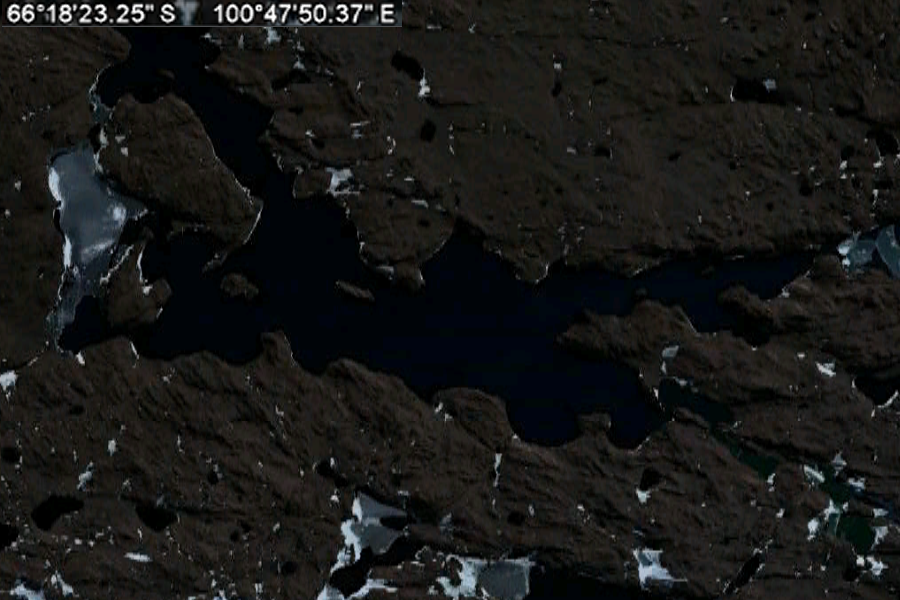
66°18'23.25"S 100°47'50.37"E "The leader of Operation Highjump, Admiral Richard E. Byrd, famously stated that the Bunger Hills was one of the most remarkable regions on earth. An island suitable for life had been found in a universe of death."
66°13'03.69"S 100°58'33.00"E |
|||
|
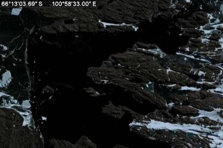
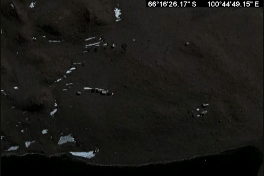
Bunger Hills or Bunger Lakes or Bunger Oasis is a coastal range on the Knox Coast in Wilkes Land in Antarctica, consisting of a group of moderately low, roundedcoastalhills, overlain by morainicdrift and notably ice free throughout the year, lying south of the Highjump Archipelago.[1] The Bunger Hills are located with its center at 66°17'S, 100°47'E, stretching from 65°58'S to 66°20'S and from 100°20'E to 100°28'E. The Bunger Hills are marked by numerous melt ponds and are nearly bisected by an east-west trending Algae Lake (also known as Lake Figurnoye). Mapped from air photos taken by the United States Navy Operation Highjump (1946-1947) and named by the United States Advisory Committee on Antarctic Names (US-ACAN) for Lieutenant Commander David E. Bunger, United States Navy, plane commander of one of the three USN OpHjp aircraft which engaged in photographic missions along most of the coastal area between 14 E and 164 E. David E. Bunger and members of his crew landed their airplane on an unfrozen lake here in February 1947. The Bunger Hills are surrounded by glaciers. On the southeast the Bunger Hills is bordered by the steep slopes of the Antarctic ice sheet, on the south and west by outlet glaciers, and on the north by Shackleton Ice Shelf, which separates the area from the open sea. The ice-free area measures 450 km sq (174 sq mi), according to some sources even 750 or 942 km sq (290 or 364 sq mi) (though these latter values include a marine area not covered by continental ice or the Shackleton Ice Shelf). The topography is characterized by rugged hills, and there are many freshwater and salt lakes. The largest and deepest lake, Algae Lake (Lake Figurnoye) is 25 km (16 mi) long and up to 137 metres (449 ft) deep. The leader of Operation Highjump, Admiral Richard E. Byrd, famously stated that the Bunger Hills was one of the most remarkable regions on earth. An island suitable for life had been found in a universe of death.[2] Cape Hordern is an ice-free cape, overlain by morainic drift, at the western end of the Bunger Hills. It was first observed by members of the western party of the Australian Antarctic Expedition (1911-1914), who were unable to reach it due to heavy crevassing on the Denman and ScottGlaciers. Stations The Soviet Union built a scientific station by the name of Oazis in the center of the area at 66°16'29"S, 100°44'49"E, starting October 15, 1956, with two buildings for eight people. The station was handed over to Poland on January 23, 1959, and was renamed A. B. Dobrowolski Station (named after Antoni Dobrowolski). It continued to be occupied for a few weeks only thereafter. On February 22, 1979 (with preparations starting February 18) the station was reactivated for a short time, but an overwintering attempt failed, and the occupants had to be evacuated to Mirny Station (350 km/220 mi to the west) on March 17. The concrete pillar erected by the First Polish Antarctic Expedition at Dobrowolski Station in January 1959 for gravity measurements, and the magnetic observatory at the station with plaque in memory of the opening of Oazis Station in 1956, are recognized as Antarctic Historic Sites.[2] The Soviet Union became interested in the Bunger Hills again in the late 1980s, and built a new station - Oazis-2 - a few hundred metres to the west of Dobrowolski. The station was used for summer visits up to the mid-1990s. About 7 kilometres (4.3 mi) WNW of Dobrowolski, at 66°15'S,100°36'E, Australia has maintained the summer-only station Edgeworth David Base, named after Edgeworth David, since 1986. SOURCE: Wikipedia Bunger Hills References:
|
|||
|
..
66° 16' 26.17" S, 100° 44' 49.15" E ..
..
The station was handed over to Poland on January 23, 1959, and was renamed A. B. Dobrowolski Station |
|||
| FAIR USE NOTICE: This page contains copyrighted material the use of which has not been specifically authorized by the copyright owner. Pegasus Research Consortium distributes this material without profit to those who have expressed a prior interest in receiving the included information for research and educational purposes. We believe this constitutes a fair use of any such copyrighted material as provided for in 17 U.S.C § 107. If you wish to use copyrighted material from this site for purposes of your own that go beyond fair use, you must obtain permission from the copyright owner. | |||
|
|