|
The Enigmas on Earth |
|||||||
|
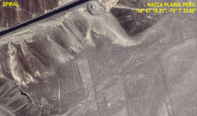
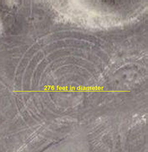
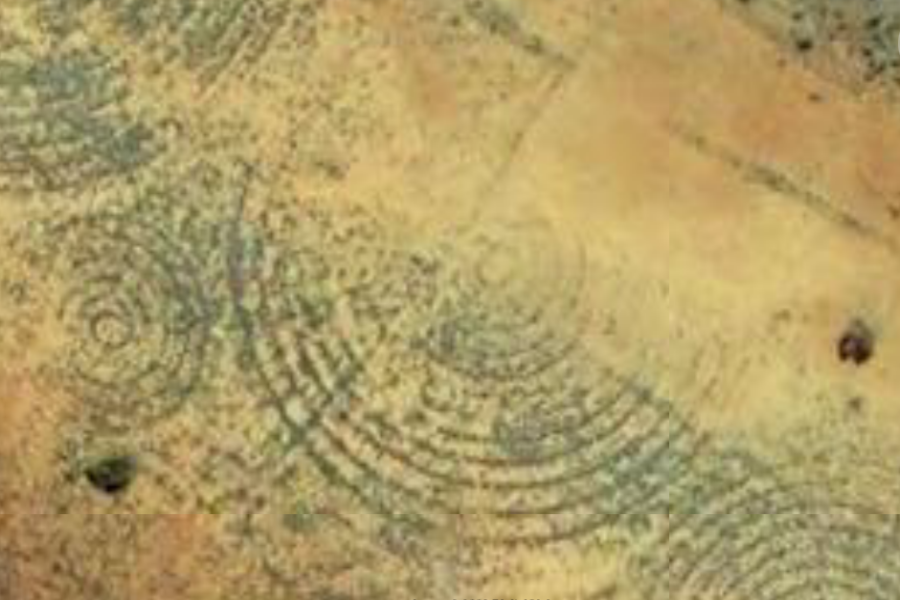
Nazca Plains, Peru and Pine Gap Spirals Northern Territory, Australia -23° 49' 17.67", +133° 49' 58.79" The Spiral on the Nazca Plains in Peru
|
|||||||
|
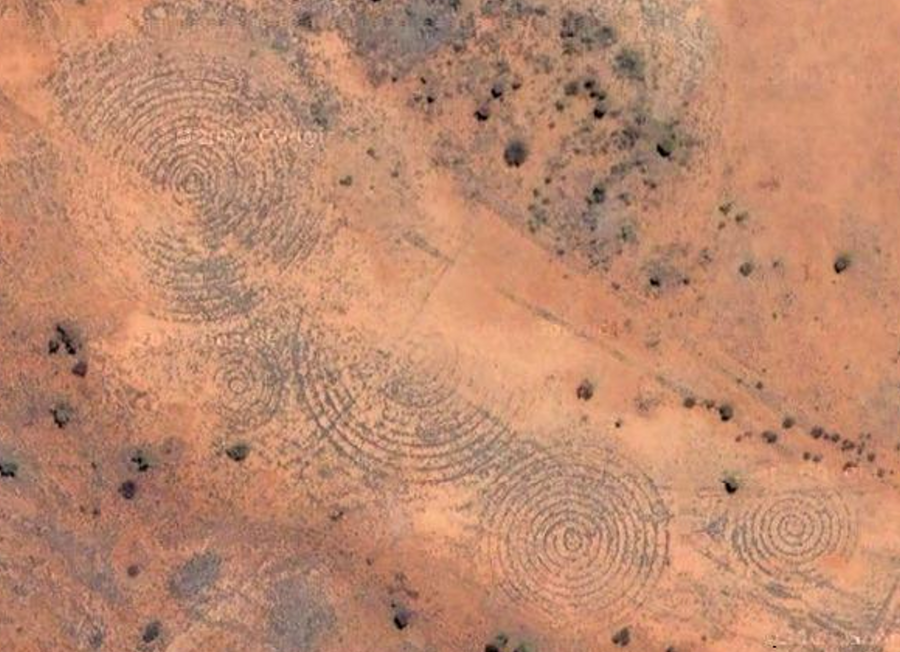
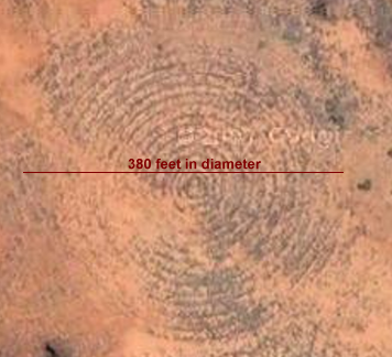
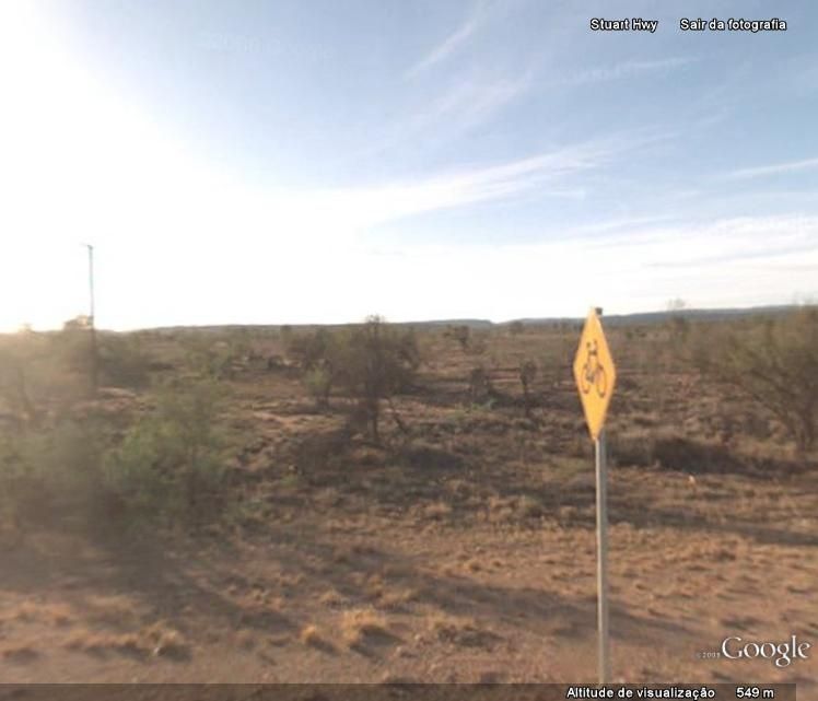
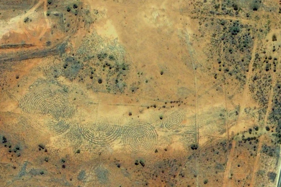
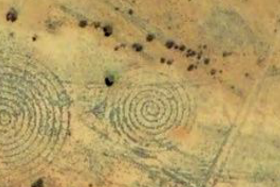
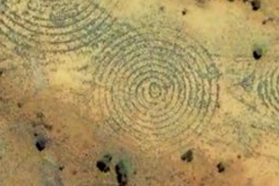
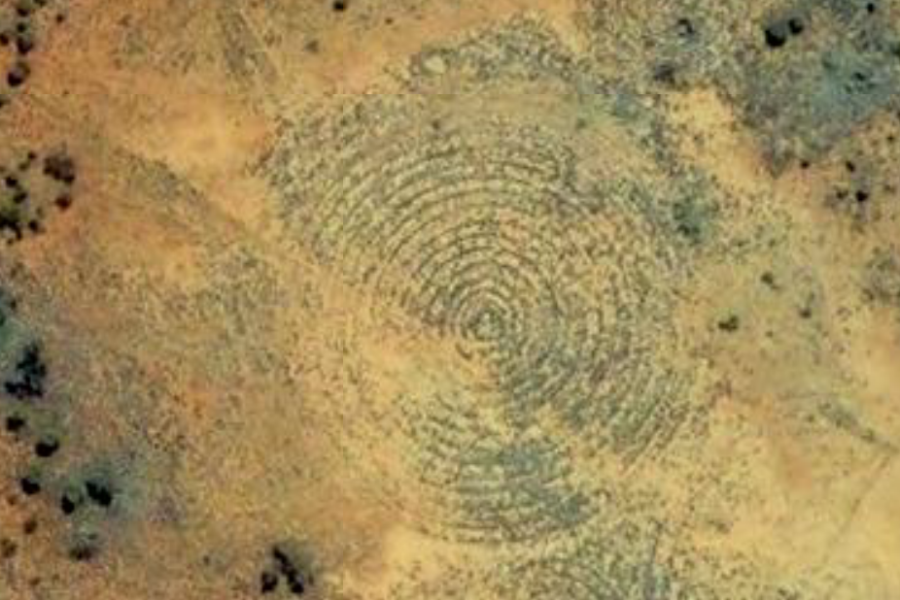
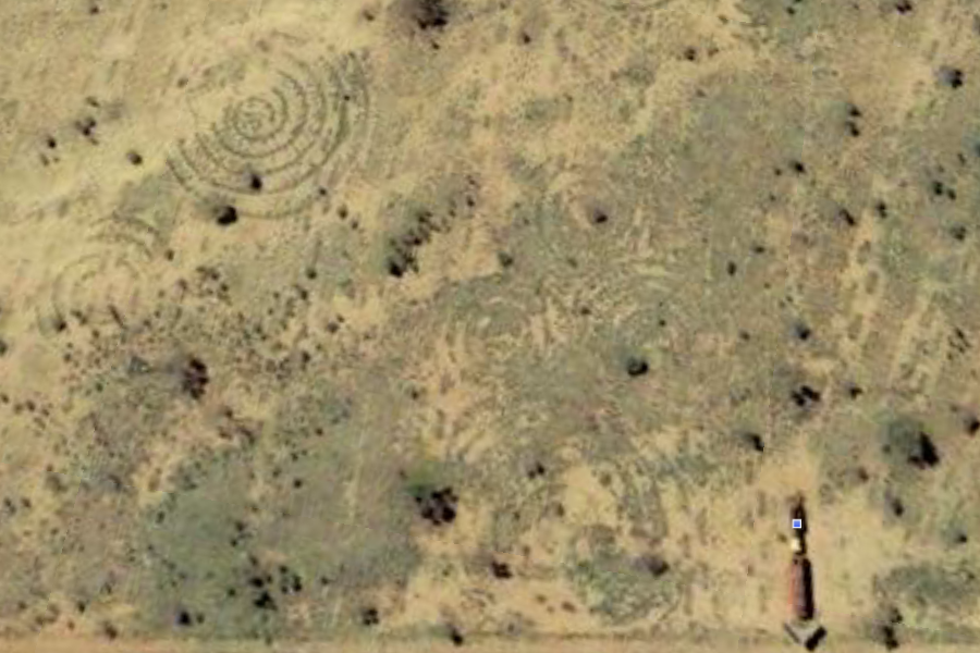
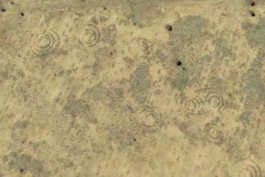
Northern Territory, Australia -23° 49' 17.67", +133° 49' 58.79" Location #1 - Google Earth 2007
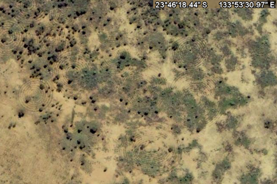
Spirals and Lines at the intersection of Hatt Rd (entrance to Pine Gap) and Stuart Hwy, Western Australia. Click on the image to zoom in for the full details. The Spirals are in the sandy area, the lines to the right of the highway.
It has been suggested that these are irrigation circles... yet most irrigation circles are concentric rings from the wheels and sprayers. Also there is no sign of farming in this area, being the entrance to Pine Gap military extablishment It has been suggested that these are erosion protection marks, yet the area is flat, and the circles are overlapping, random sizes and very precicely drawn So... I decided it was time to write some emails... Sent: Tuesday, 1 September 2009 6:47 AMLETTER #1 Sent: Tuesday, 1 September 2009 10:40 AM
From: Siro Felicity On Behalf Of Library ReferenceLETTER #3 Sent: Tuesday, 1 September 2009 12:11 AMLETTER #4 Sent: Monday, 31 August 2009 10:13 PMLETTER #5 Subject: Re: Geoglyphs near Alice Springs [SEC=UNCLASSIFIED] |
|||||||
|
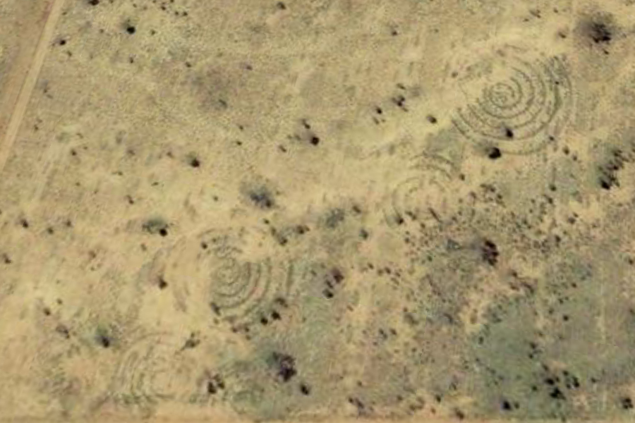
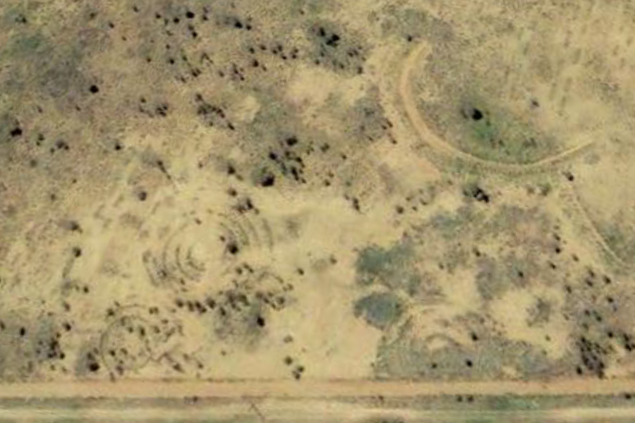
Northern Territory, Australia -23° 49' 17.67", +133° 49' 58.79" .... Location #1 - Google Earth Update 2009 ....
|
|||||||
|
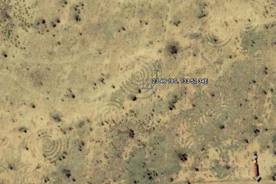
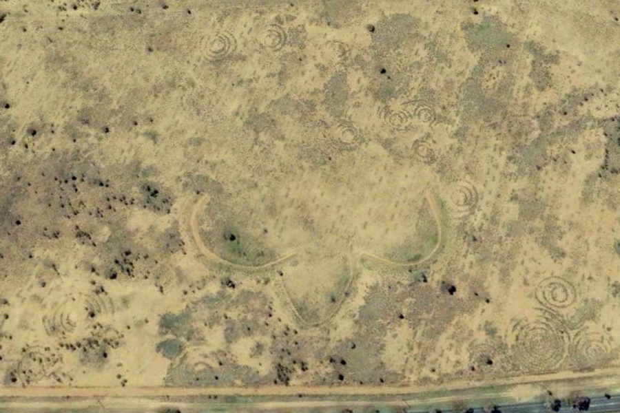
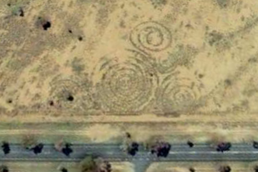
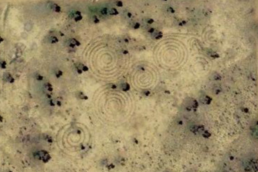
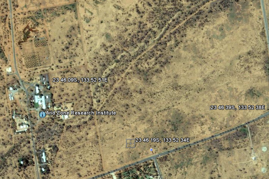
Northern Territory, Australia -23° 46' 19.00", +133° 52' 34.00" Location #2 - Google Earth 2009
|
|||||||
|
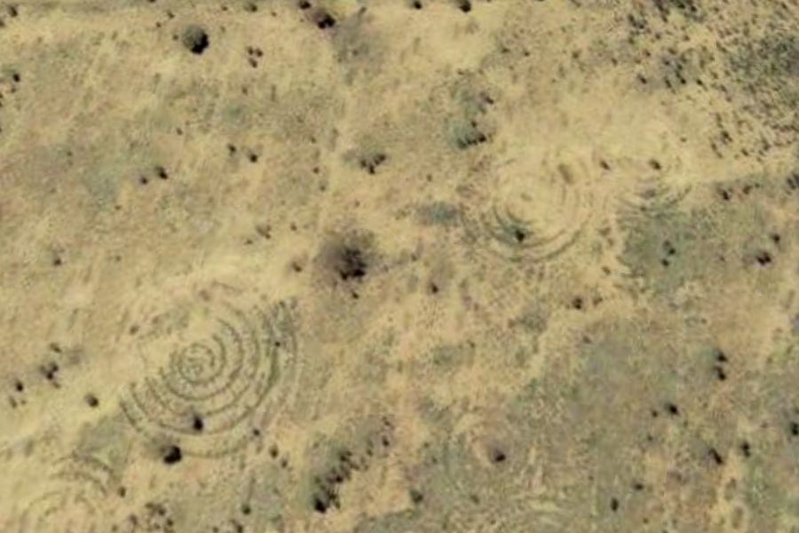
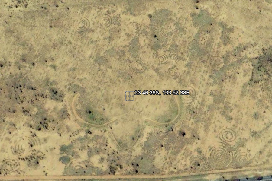
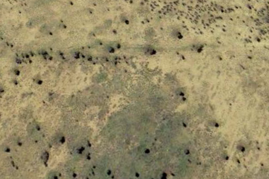
Northern Territory, Australia -23° 46' 39.00", +133° 52' 38.00" Location #3 - Google Earth 2009
|
|||||||
|
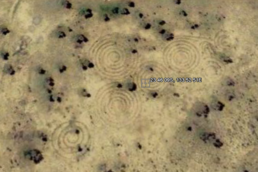
Northern Territory, Australia -23° 46' 9.00", +133° 52' 51.00" Location #4 - Google Earth 2009
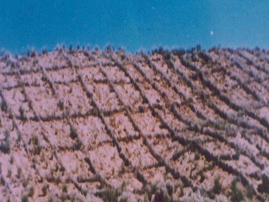
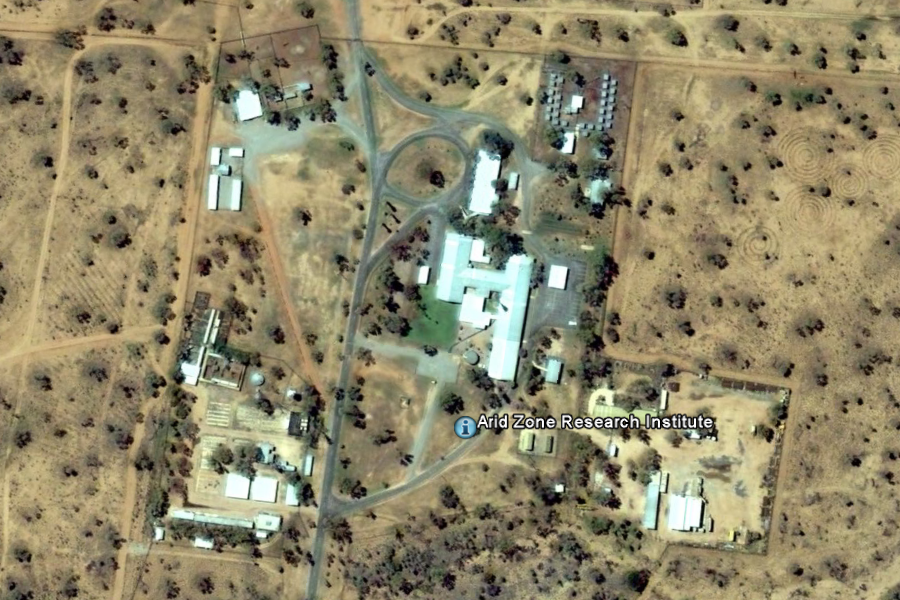
Credit: Central Arid Zone Research Institute Alice Springs, Northern Territory, Australia Arid Zone Research Institute -23° 45' 59.59", +133° 52' 50.32"
|
|||||||
|
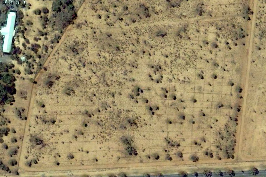
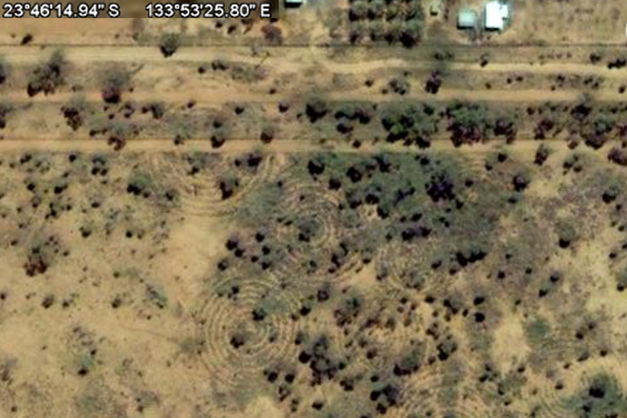
Northern Territory, Australia -23° 46' 14.94", +133° 53' 25.80" Location #5 - Google Earth 2009
Spirals Area
#4
|
|||||||
|
34° 58' 58.26", -106° 31' 42.30"
+34° 58' 32.64", -106° 31' 38.28" |
|||||||
|
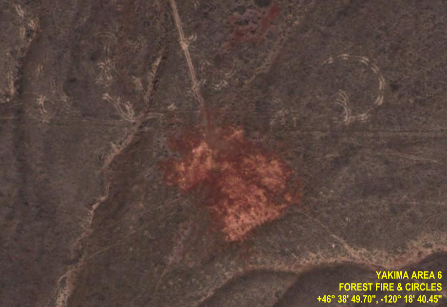
+46° 38' 49.70", -120° 18' 40.45"
Just to the East of the Yakima Training Center (Washington, US) ECHELON Station, I spotted this forest fire. But I am more interested in what these circles in the forest are. Related Links:
|
|||||||
|
Cabeceras de Izcagua La Palma, Canary Islands
Overcrowded in their lower reaches they might be, but the Canary Islands still possess some solitary mountain wildernesses, places little visited thanks to their rugged inaccessibility, and which have hardly changed since they were frequented by the pre-colonial aboriginal islanders. And traces of their presence are still turning up, often in the form of petroglyphs, enigmatic scratched marks on rocks and boulders which held some special significance about which we can only guess today. The latest find is, say archaeologists, one of the most exciting. They are calling it a cosmic clock, a description guaranteed to get the imagination of any sci-fi fans racing. But there are no flashing lights and strange dials. The reality, a piece of stone 44 centimetres high and 34 wide, would certainly disappoint them, but the experts are hailing the Summer Stone as a major discovery. Found on the
rarified heights of Cabeceras de Izcagua in La
Palma, at an altitude of 2,140metres, on a site
inhabited by the Awaras (as the original
inhabitants of that island were called), it is
thought that the stone was instrumental in
calculations to mark the equinoxes. The stone has
symbols of the sun facing north-east scratched
upon it. Strangely enough that mountain is still associated with sky-watching. The Roque de Los Muchachos is the site of a world famous observatory which houses one of the world’s largest telescopes. An odd case of back to the future. AW |
|||||||
|
Nine Mile Canyon, Utah Petroglyphs Spiral and Serpent Petroglyph ..
Once again we see the spiral represented in another ancient culture. This one even has a serpent exiting the 'wormhole' and a set of dots on one side. This is a theme seen all over the planet. |
|||||||
| FAIR USE NOTICE: This page contains copyrighted material the use of which has not been specifically authorized by the copyright owner. Pegasus Research Consortium distributes this material without profit to those who have expressed a prior interest in receiving the included information for research and educational purposes. We believe this constitutes a fair use of any such copyrighted material as provided for in 17 U.S.C § 107. If you wish to use copyrighted material from this site for purposes of your own that go beyond fair use, you must obtain permission from the copyright owner. | |||||||
|
|


 Webpages © 2001-2019 Blue Knight Productions |