|
West Australia |
|||||||||||||
|
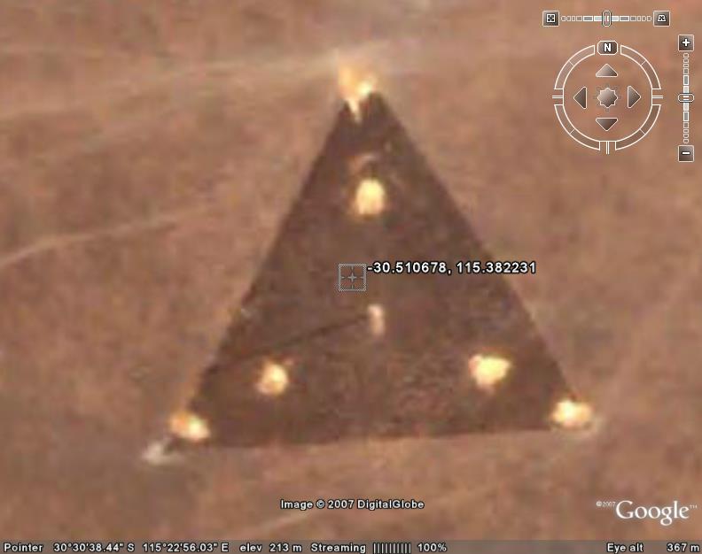
30° 30' 38.44" S, 115° 22' 56.03" E ..
|
|||||||||||||
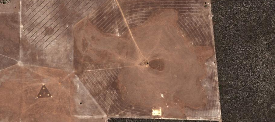
| Is it a structure, discoloured earth, ‘land art’ or
one of the legendary flying
triangles seen around the world for the past two decades or so?
From The Why Files: “There has been some talk of the construction of a U.S. base in Western Australia near the town of Geraldton. Take a look at Coordinates 30°30'38.44" S 115°22'56.03" E on Google Earth and you will discover a triangular-shaped image. It doesn’t appear to be a craft or even a building and it could, of course, just be a filling image in a situation where the original Google image was not useable.” One poster estimates the object, if it is an object, to be 360ft across, which would tally with guesstimates made by flying triangle witnesses on the ground, who habitually refer to them as being “football pitch sized.” ON a sobering note, the Wikipedia entry for flying triangles notes: The director of NUFORC, Peter B. Davenport, claimed that the object was a radio tower: "It is a radio tower. You can see the shadow of the tower at the 8:30 position” Over at the UFO Updates mailing list, one Martin Shough had this to say: “I don’t see it as a 'triangular craft sitting on the ground', I see it as a cleared patch of the desert about 110 m on a side, associated with some structure, possibly a tall mast with a tripod of cable stays. There’s a dark line running away from the centre. If you go a mile or so north (staying inside the same image tile) there are some low buildings which show the shadow direction - this looks to me to be consistent with the dark line being a shadow of a tall mast. I think perhaps the bright spots that look like “lights” but are actually about 20 ft across or more are disturbed areas where the light subsoil has been exposed in excavation to anchor the mast and the stays. There are other patches around the area that look like quarries etc., that have the same bright colouring. That probably suggests a new installation, which would fit if it were connected to that new “super secret spy base” mentioned as being constructed nearby.” |
|||||||||||||
|
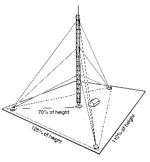
..
Guy radius = 70% Side A = 125% Side B = 110% Most manufacturers suggest a standard outer guy radius of 70 percent (80 percent for microwave) of the overall tower height. At this radius, downloads on the tower structure from the guys are minimized resulting in the least-cost tower to meet a particular antenna and wind load requirement. As the guy radius is reduced below 70 percent, the downward pulling force of the guy system is increased as a result of the sharper angle of the guy relative to the structure. This increased downward force will result in the need for a stronger, more expensive tower and a heavier, more expensive guy system. If properly designed, shortening the guy system to 40-50 percent of tower height does not compromise the tower's ability to support the load intended or to meet the requirements of the EIA RS-222 code. However, tower and foundation costs will definitely be greater. |
|||||||||||||
|
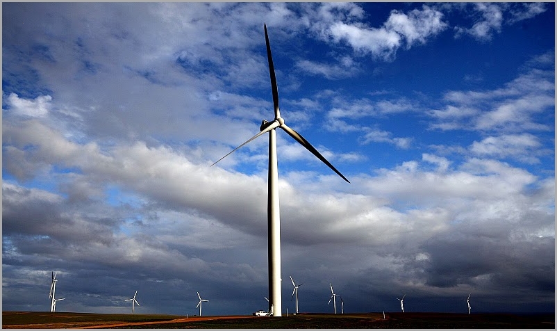
Emu Downs Windmill Farm ..
Emu Downs for sale
SOURCE: GE Triangle UFO in Australia |
|||||||||||||
|
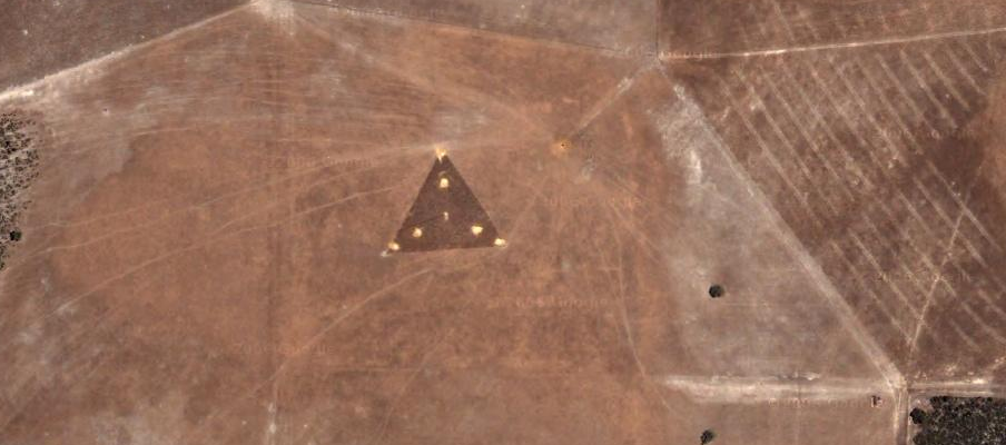
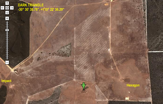
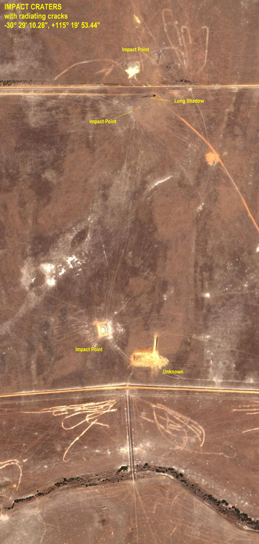
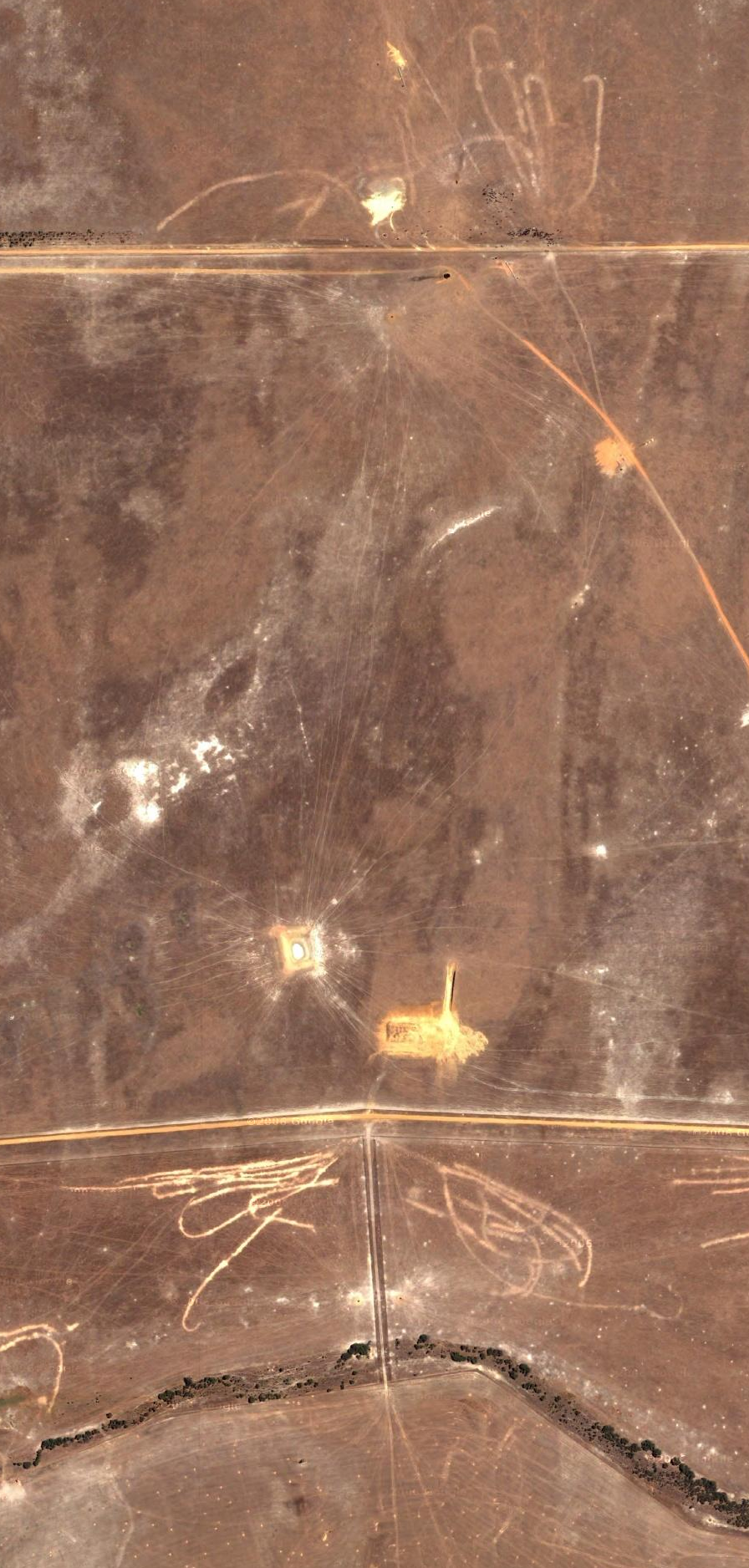
..
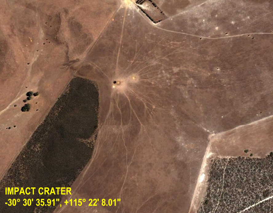
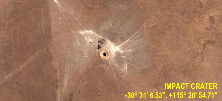
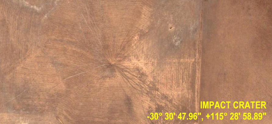
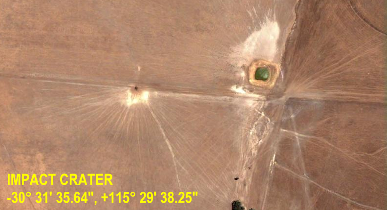
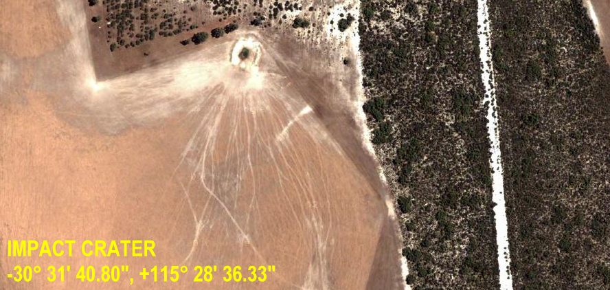
Many have paid attention to the dark triangle near Cervantes, but few look further... but the area surrounding the "Triangle" has some other interesting features... In the image above you can see a crater with radiating cracks just to the right... and as we see below on zooming out a little further we get grid lines... perhaps layouts for another HAARP like facility?
As a mater of fact the whole
area is covered in craters, much like the bomb craters at the Kirtland
AFB Site. This site would be well worth watching for future versions
of Google Earth. The image below shows an overview...
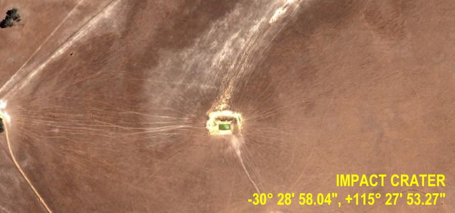
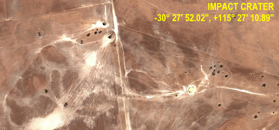
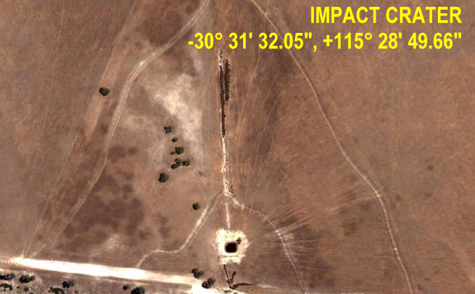
Now we will take a closer look at several of the craters we found in the area... We have marked the main ones in the map below but if you look closely for the telltale ray patterns you will find others.
|
|||||||||||||
| FAIR USE NOTICE: This page contains copyrighted material the use of which has not been specifically authorized by the copyright owner. Pegasus Research Consortium distributes this material without profit to those who have expressed a prior interest in receiving the included information for research and educational purposes. We believe this constitutes a fair use of any such copyrighted material as provided for in 17 U.S.C § 107. If you wish to use copyrighted material from this site for purposes of your own that go beyond fair use, you must obtain permission from the copyright owner. | |||||||||||||
|
|