|
The Enigmas on Earth |
||||
|
|
||||
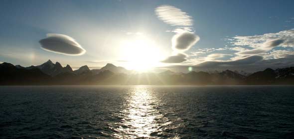
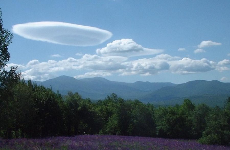
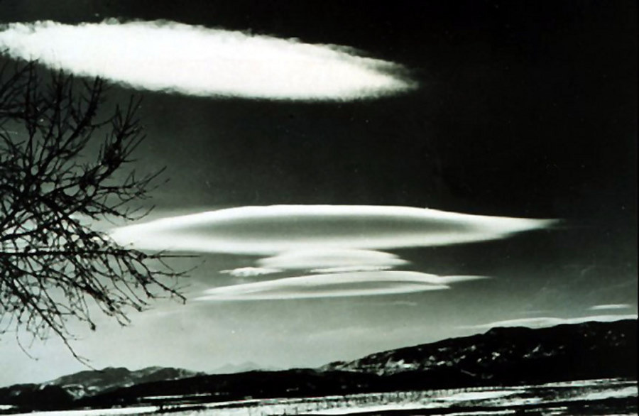
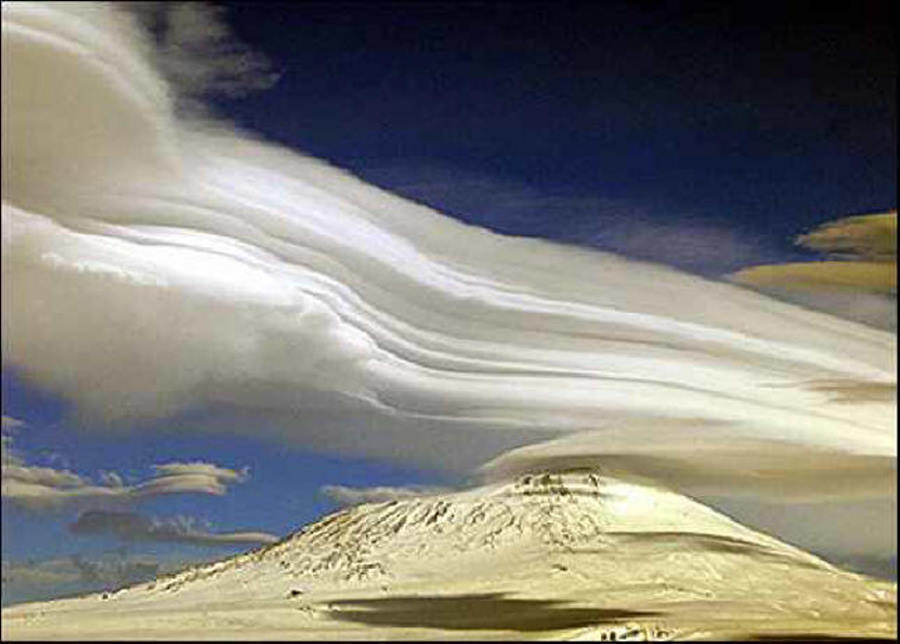
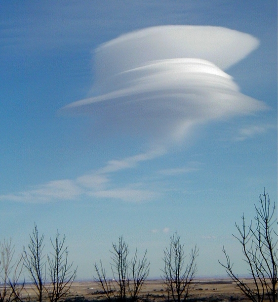
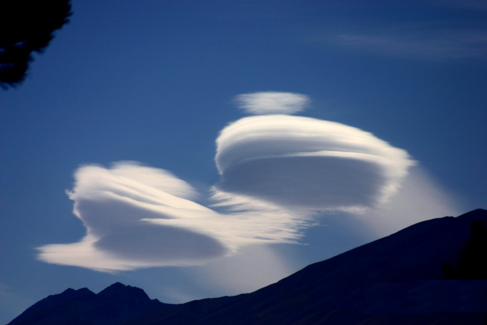
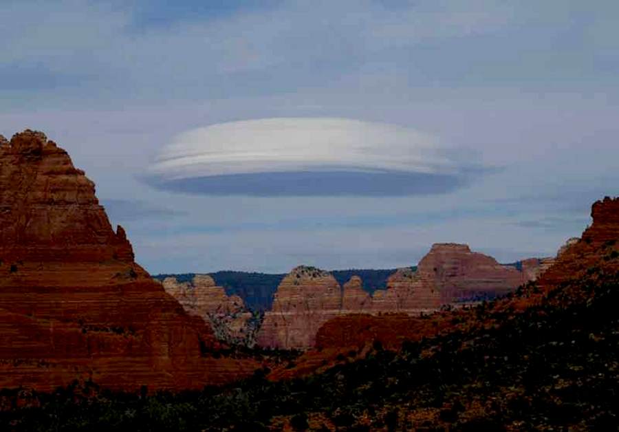
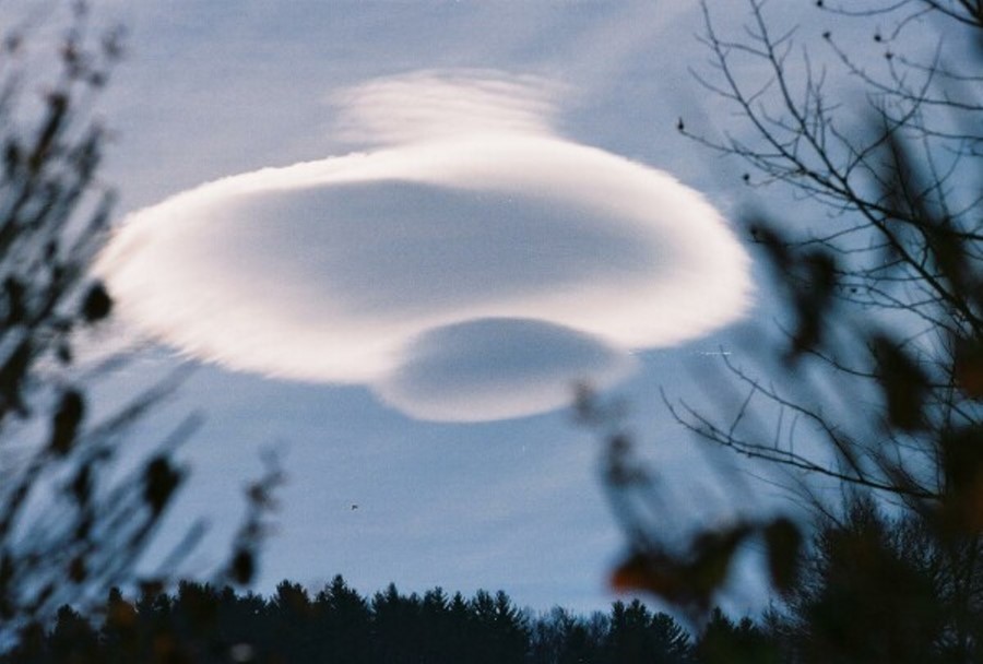
These formations are frequently caused by wave motions in the atmosphere, and are frequently seen in mountains or hilly areas. They are often called "wave clouds" They may be triggered off by hills only a few hundred metres high, and may extend downwind for over 100 KM The cloud elements form at the windward edge of the cloud and are carried to the downwind edge - where they evaporate. The cloud as a whole is usually stationary - or slow moving. These clouds often have very smooth outlines, and show definite shading. At sea they are likely to be seen only to landwards. SOURCE: South Georgia Island |
||||
|
Damascus, Syria ...
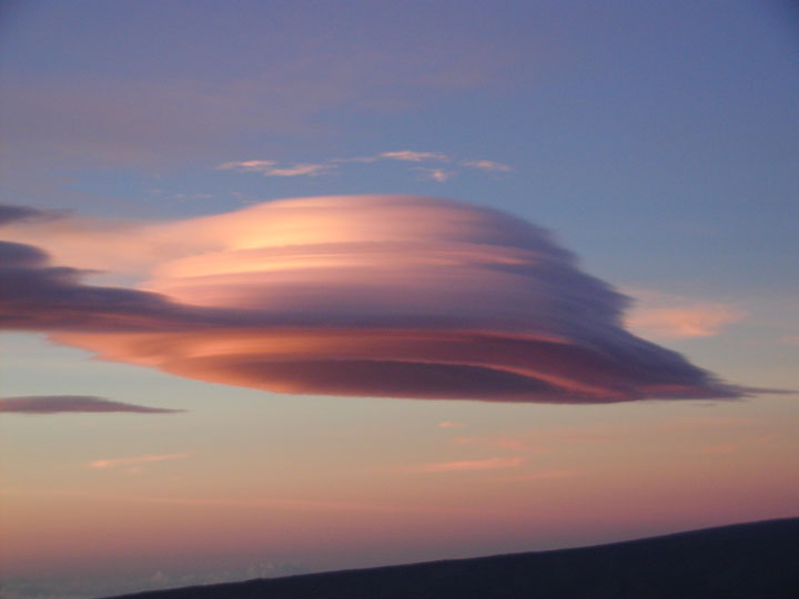
lar Cloud Over Hawaii ..
December 1,
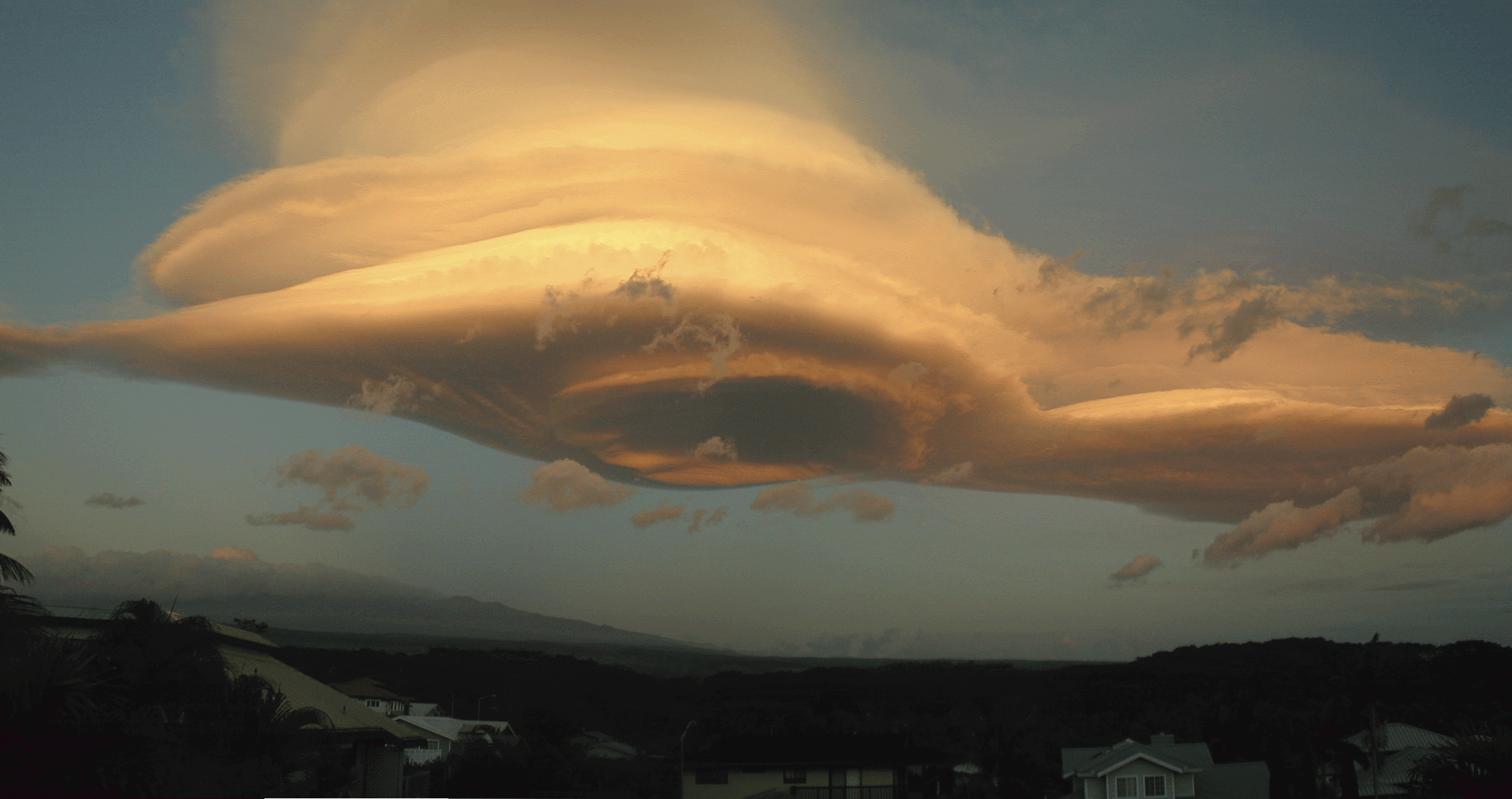
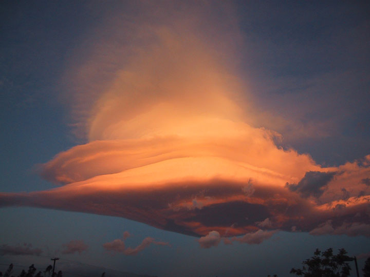
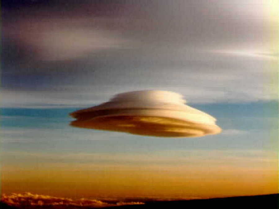
2003 Can a cloud do that? Actually, pictured above are several clouds all stacked up into one striking lenticular cloud. Normally, air moves much more horizontally than it does vertically. Sometimes, however, such as when wind comes off of a mountain or a hill, relatively strong vertical oscillations take place as the air stabilizes. The dry air at the top of an oscillation may be quite stratified in moisture content, and hence forms clouds at each layer where the air saturates with moisture. The result can be a lenticular cloud with a strongly layered appearance. The above picture was taken last week near Mauna Kea, Hawaii, USA. SOURCE: NASA APOD November 26, 2003 - Space.com Astronomers are always looking up. Sometimes they see interesting things that aren't as far up as we normally think they're looking. Peter Michaud, a public information officer for the Gemini Observatory in Hawaii, took this picture yesterday of an unusual cloud formation above the islands. It is called a lenticular cloud, due to its lens-shaped appearance. These clouds are formed by so-called mountain waves of air created by strong winds forced over high mountains. In this case, the mountain is Mauna Kea, a 13,796-foot peak (4,260 meters) where one of the two Gemini telescopes sits, along with several other observatories. (A twin to the Hawaiian Gemini scope is situated in Chile.) "At the high points in the wave, moisture in the air condenses out to form a cloud," Michaud explained. "In the photo you can see that the wave established this morning displayed two peaks. Actually there were four -- two more were downstream from Mauna Loa, but the other two were not as impressive as Mauna Kea's!" |
||||
|
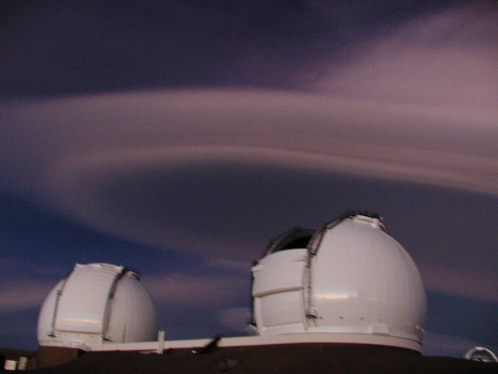
Lenticular Clouds ....
Lenticular clouds often form around Mauna Kea and Mauna Loa like this one ....
This Lenticular cloud remained in place over 36 hours while summit winds roared ....
This Lenticular cloud appears to be swallowing up the twin Keck domes ....
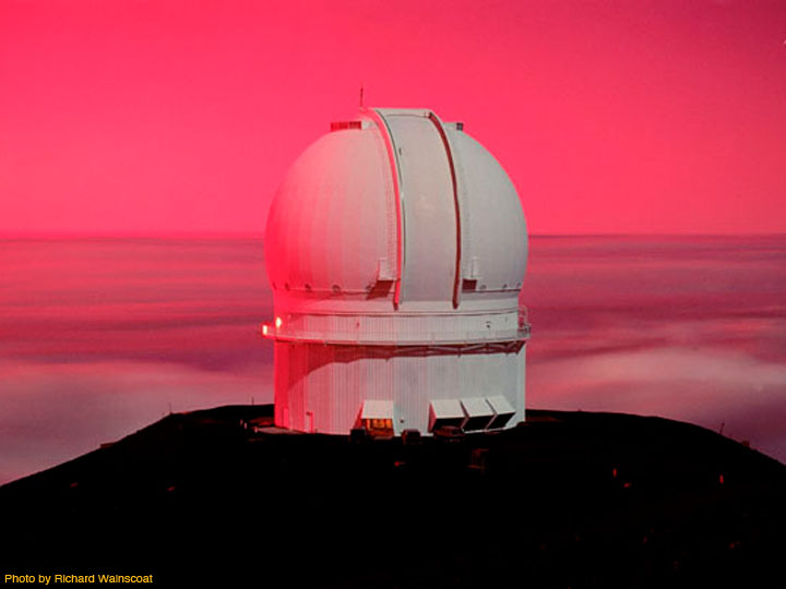
Canada-France-Hawaii Telescope painted in pink by a dramatic sunset at the summit Mauna Kea Pictures There is really no place on Earth
quite like the summit of Mauna Kea - a special place
for Hawaiian culture and for the science of
astronomy. Here are some images that only begin to
hint at the beauty of the majestic white mountain
known as Mauna Kea. SOURCE: Mauna Kea |
||||
|
..
|
||||
|
..
|
||||
|
October 2002 ..
|
||||
|
2007 ..
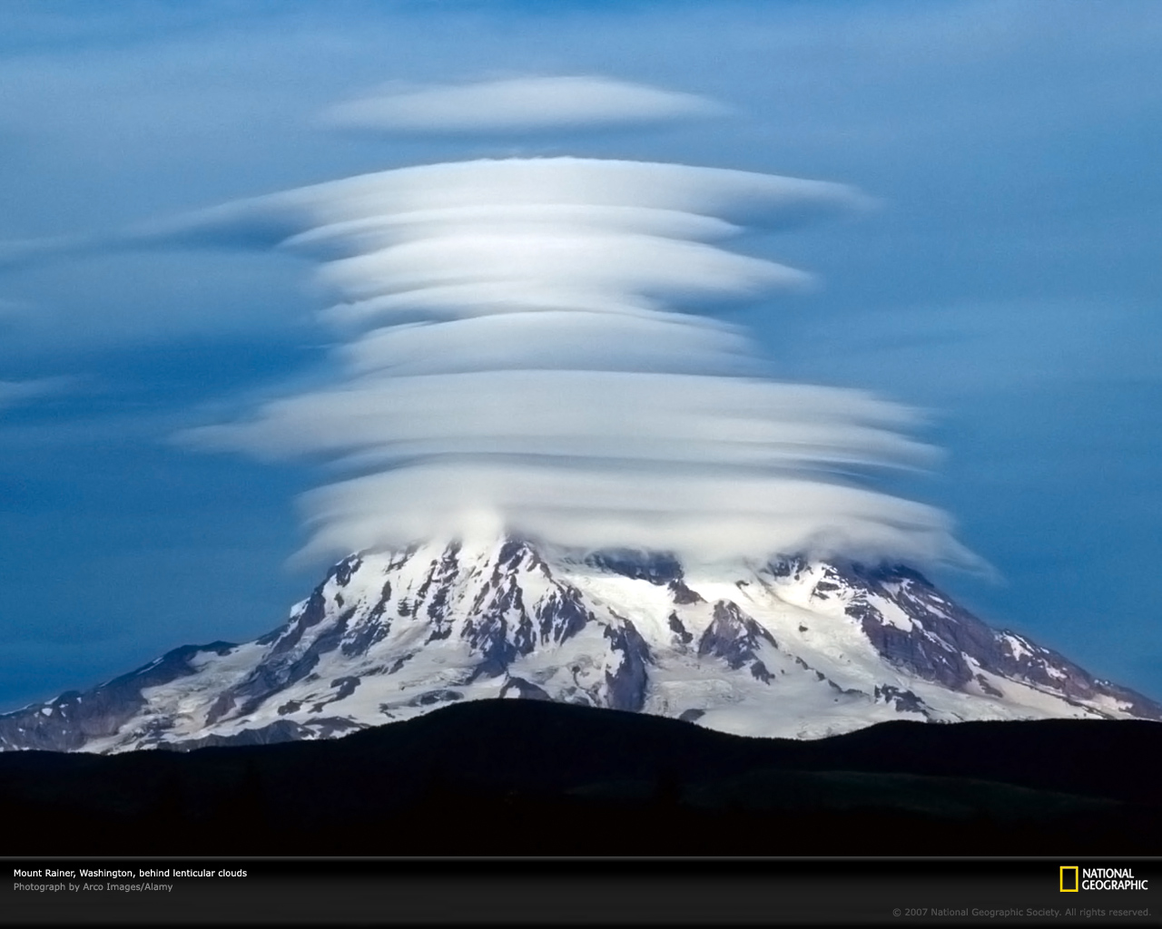
The summit of
Washington's Mount Rainier lies hidden beneath a
stack of horizontally layered lenticular clouds.
These clouds are formed by high winds blowing over
rough terrain and are sometimes described as a
"stack of pancakes." |
||||
|
2005 ..
Lenticular cloud over Mt Rainier from Puyallup Ridge trail, Mt Tahoma Trails |
||||
|
..
|
||||
|
McMurdo Sound, Antarctica ..
|
||||
|
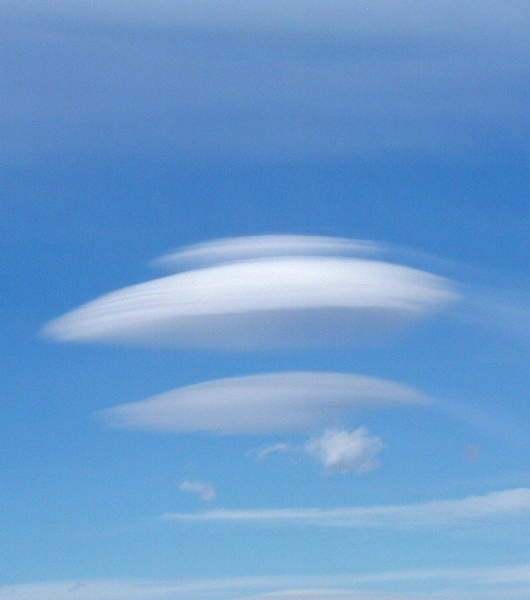
Explanation: Why does this cloud look so strange? Actually, pictured above are several clouds all stacked up into one striking lenticular cloud. Normally, air moves much more horizontally than it does vertically. Sometimes, however, such as when wind comes off of a mountain or a hill, relatively strong vertical oscillations take place as the air stabilizes. The dry air at the top of an oscillation may be quite stratified in moisture content, and hence forms clouds at each layer where the air saturates with moisture. The result can be a lenticular cloud with a strongly layered appearance. The above picture was taken in 1999 over Plymouth, New Hampshire, USA. The same lenticular cloud also looks strange when photographed from 30 kilometers away. SOURCE: NASA APOD |
||||
|
..
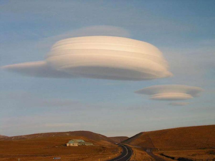
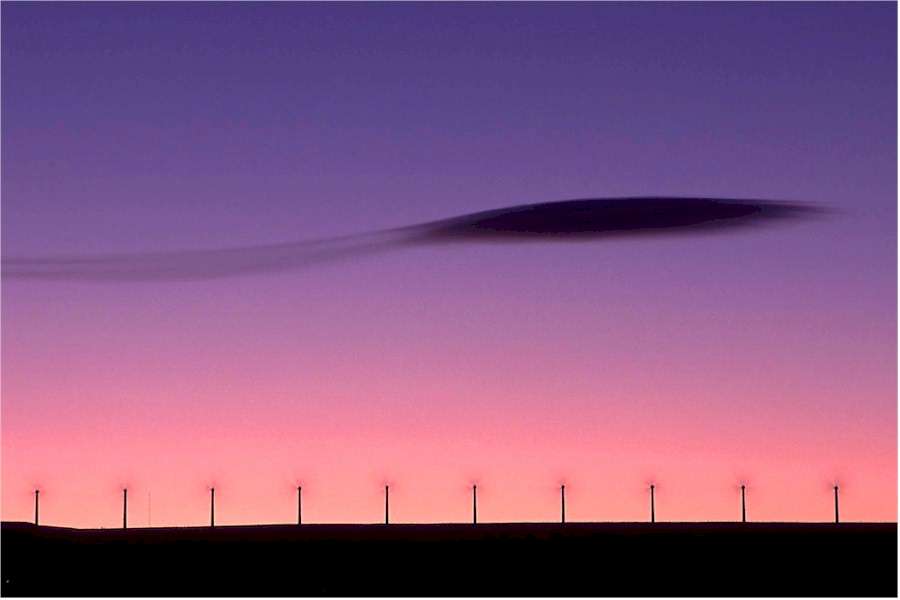
A Lenticular Cloud over Windmills Explanation: Is that a cloud or a flying saucer? Both, although it is surely not an alien spacecraft. Lenticular clouds can be shaped like a saucer, and can fly in the sense that, like most clouds, they are composed of small water droplets that float on air. Lenticular clouds are typically formed by high winds over rugged terrain and are particularly apparent when few other clouds are in the sky. Lenticular clouds can take on particularly strange, layered shapes. Above, a couple stopped their car near Yellowstone National Park in Wyoming, USA to photograph this lenticular cloud behind picturesque windmills. SOURCE: NASA APOD |
||||
|
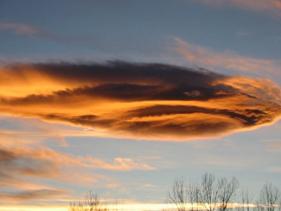
Colorado ..
Eyes in the Storm |
||||
|
..
|
||||
|
..
Eyes in the Storm |
||||
|
March 20, 2002 These photos of the lenticular clouds on 20 March, 2002 were taken by Bill Randel at http://acd.ucar.edu/~randel/clouds.html . Bill is a scientist in the Atmospheric Chemistry Division at NCAR whose research interests include dynamic variability and climatology of the stratosphere and the observed variability of trace constituents in the middle atmosphere using satellite observations.
..
..
..
|
||||
|
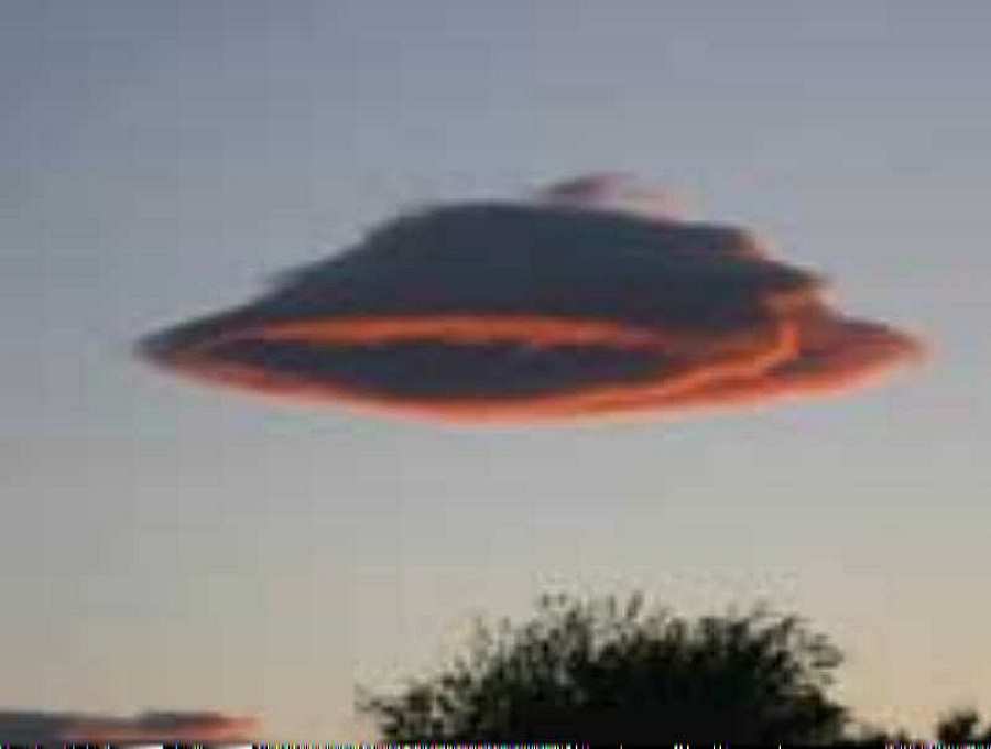
Mistaken for a UFO ..
|
||||
|
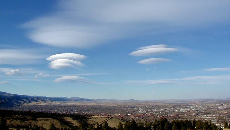
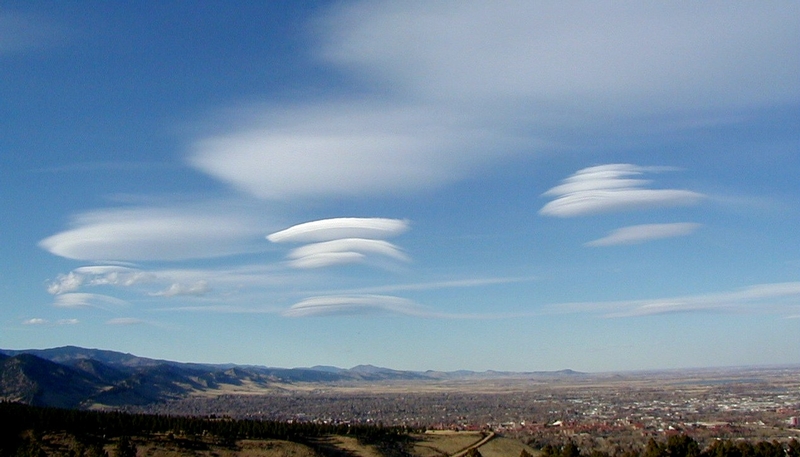
West
Spanish Peak
located south of Walsenburg, Colorado.
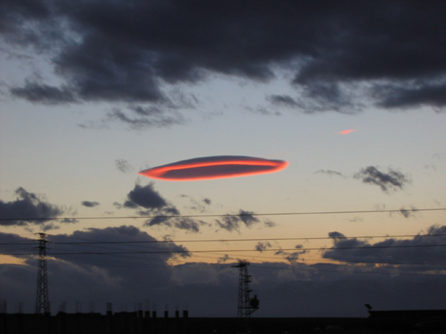
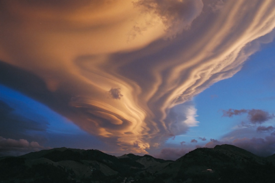
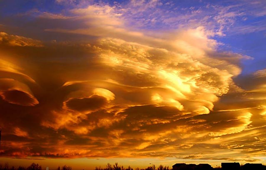
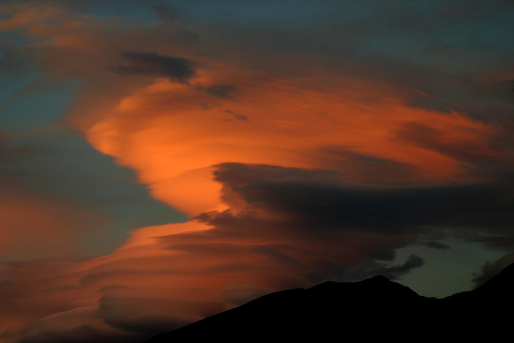
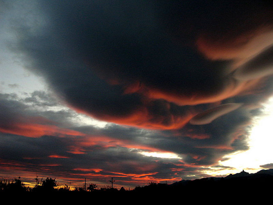
Lenticular clouds, technically known as altocumulus standing lenticularis, are stationary lens-shaped clouds that form at high altitudes, normally aligned at right-angles to the wind direction. Where stable moist air flows over a mountain or a range of mountains, a series of large-scale standing waves may form on the downwind side. Lenticular clouds sometimes form at the crests of these waves. Under certain conditions, long strings of lenticular clouds can form, creating a formation known as a wave cloud. Power pilots tend to avoid flying near lenticular clouds because of the turbulence of the rotor systems that accompany them, but sailplane pilots actively seek them out. This is because the systems of atmospheric standing waves that cause "lennies" (as they are sometimes familiarly called) also involve large vertical air movements, and the precise location of the rising air mass is fairly easy to predict from the orientation of the clouds. "Wave lift" of this kind is often very smooth and strong, and enables gliders to soar to remarkable altitudes and great distances. The current gliding world records for both distance (over 3,000km) and altitude (14,938m) were set using such lift. Lenticular clouds have been mistaken for UFOs (or "visual cover" for UFOs) because these clouds have a characteristic lens appearance and smooth saucer-like shape SOURCE: Crystal
Links
Lenticular Clouds
Credit: The photo was taken 5-20-2003 by me, Mark J. Madigan, of Colorado Springs, CO. |
||||
|
Lake Ohau Alpine Village, New Zealand ..
Taken from McKinnon Reserve, Stacked Lenticular Clouds above Ben Ohau Range as seen from Lake Ahau Alpine Village, at midday, 12:15 pm ..*
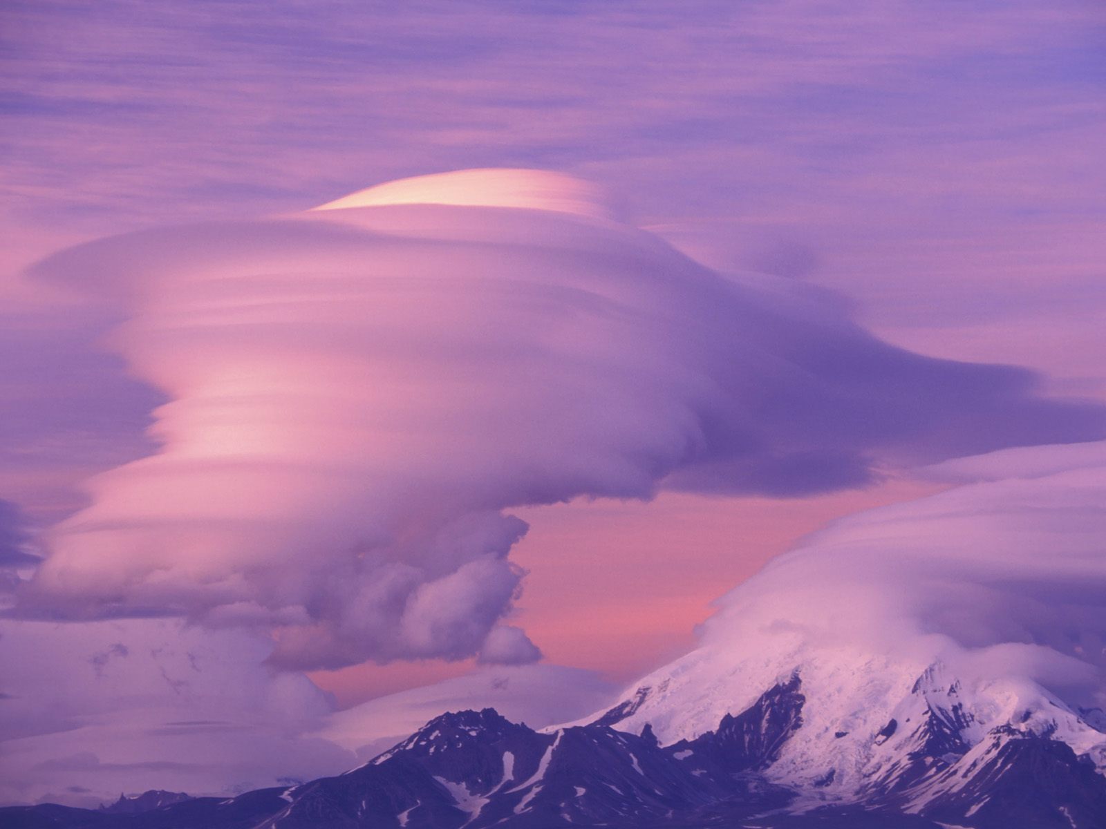
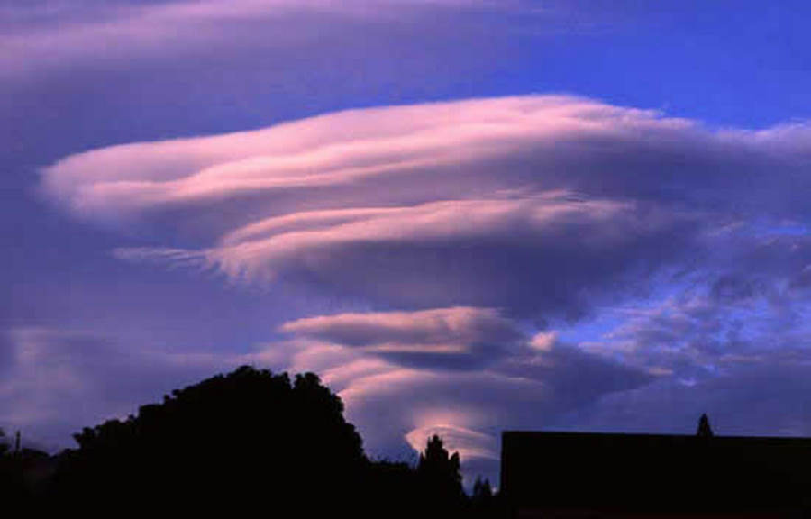
Stacked Lenticular Clouds above Ben Ohau Range as seen from Lake Ahau Alpine Village Sunset 10 March 2008, Sunset 8:15 Pm The 10 March 2008 was a day of interesting weather. It started fine and calm, the sky clear blue with nary a cloud. By midday lenticular clouds* had appeared as shown in the first photo above. These lenticular clouds or "lennies" as they are sometimes called, stayed through the day. The shape and number of clouds in the pancake like stack changed as new lennies formed and the older clouds at the top of the stack disappeared. Since lenticular clouds are formed by strong wind we knew that although the air was calm where we were that wind was coming. By late afternoon, the wind appeared at the far end of Lake Ohau, moved toward us and about 20 minutes later, reached Ohau Village at gale strength. The second photo above shows these clouds at sunset. (If you are interested, note the horizontal rotation about a vertical axis of the clouds in the middle of the left stack. I think it fascinating that the clouds in the middle of the stack have rotated relative to the clouds above and below, apparently due to the shear force of a westerly wind, while maintaining their vertical position in the stack.) These clouds are named "lenticular" because they are lens shaped. Strong wind passing over a high mountain produces standing waves in the air above and somewhat downwind of the mountain. If the air is moist, changing pressure (compression followed by decompression) in these waves results in condensation making the shape of these standing waves visible. Their formal name is: "altocumulus standing lenticularis" meaning a high heap of lens shaped clouds formed by a standing wave. Pilots of powered planes and pilots of sail planes (gliders) are particularly interested in "lennies" as they are not only associated with high wind but also vertical wind. They are usually avoided by power plane pilots because of the turbulence but are sought by glider pilots for the rapid vertical lift they give. Some physicists, including the author, think that standing waves are the basic building block of matter and thus the universe. Hence my fascination with lenticular clouds as they give me a visual demonstration of how matter is formed. SOURCE: An Ohau View: Lenticular clouds over the Ben Ohau Range |
||||
|
November 19, 2003 ..
On the Summit. Lenticular Clouds. Tuesday, November 11, 2003, 03:44 PM US/Pacific. |
||||
|
California's Sierra Nevada mountains ..
Lenticular Clouds at sunset over Lamarck Col, a high pass on the crest of California's Sierra Nevada mountains, along the eastern boundary of Sequoia/Kings Canyon National Parks. This high altitude cross country route is a shortcut from Bishop to the heart of the High Sierra and leads into Evolution Valley, along the John Muir Trail. |
||||
|
Dec. 26, 2006 ..
|
||||
|
..
|
||||
|
Mistaken for a UFO ..
|
||||
|
..
|
||||
|
March, 2002 ..
This photograph is part of an ongoing series of lenticular clouds. It was taken from my backyard in March, 2002, in the Ledger community, Mitchell County, N.C., 12 miles north of the Black Mountain range, looking south/southeast. It is in the same sector of the sky, as Ledger Sightings 3 and 4, but more ominous-looking, like a spaceship, though only a lenticular cloud. The name relates to two reported UFO sightings in Ledger and Mitchell County. SOURCE: Doug Sudduth |
