Antarctic Ice Shelf Disintegration
Underscores a Warming World
..
Credit: National Snow
and Ice Data Center/NASA
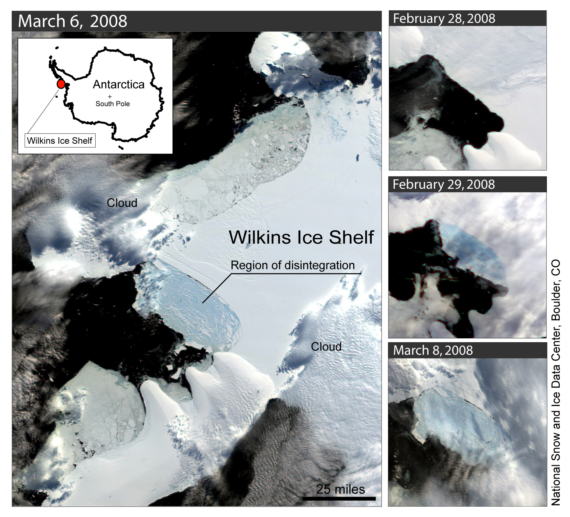
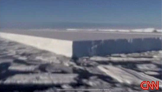
Figure 1. This series of satellite
images shows the Wilkins Ice Shelf as it began to break up. The large image
is from March 6; the images at right, from top to bottom, are from February
28, February 29, and March 8. NSIDC processed these images from the NASA
Moderate Resolution Imaging Spectroradiometer (MODIS) sensor, which flies
on NASA's Earth Observing System Aqua and Terra satellites. High-resolution
version
Posted: 25 March 2008
Updated: 21 March 2002 14:40 MST
SOURCE: http://nsidc.org/news/press/20080325_Wilkins.html
Antarctic Ice Shelf Disintegration Underscores a Warming World
This is a joint press release from the National Snow
and Ice Data Center (NSIDC), which is part of the Cooperative Institute
for Research in Environmental Sciences at the University of Colorado at
Boulder; the British Antarctic Survey (BAS), based in the United Kingdom;
and the Earth Dynamic System Research Center at National Cheng Kung University
(NCKU) inTaiwan.
Media Relations Contacts:
Stephanie Renfrow, NSIDC: srenfrow@nsidc.org
or +1 303 492-1497 (se habla Español)
Athena Dinar, BAS: amdi@bas.ac.uk
or +44 (0)1223 221414
Cheng-Chien Liu, NCKU: ccliu88@mail.ncku.edu.tw
or +886-6-2757575 X65422
Satellite imagery from the National Snow and Ice Data
Center at the University of Colorado at Boulder reveals that a 13,680 square
kilometer (5,282 square mile) ice shelf has begun to collapse because of
rapid climate change in a fast-warming region of Antarctica.
The Wilkins Ice Shelf is a broad plate of permanent
floating ice on the southwest Antarctic Peninsula, about 1,000 miles south
of South America. In the past 50 years, the western Antarctic Peninsula
has experienced the biggest temperature increase on Earth, rising by 0.5
degree Celsius (0.9 degree Fahrenheit) per decade. NSIDC Lead Scientist
Ted Scambos, who first spotted the disintegration in March, said, "We believe
the Wilkins has been in place for at least a few hundred years. But warm
air and exposure to ocean waves are causing a break-up."
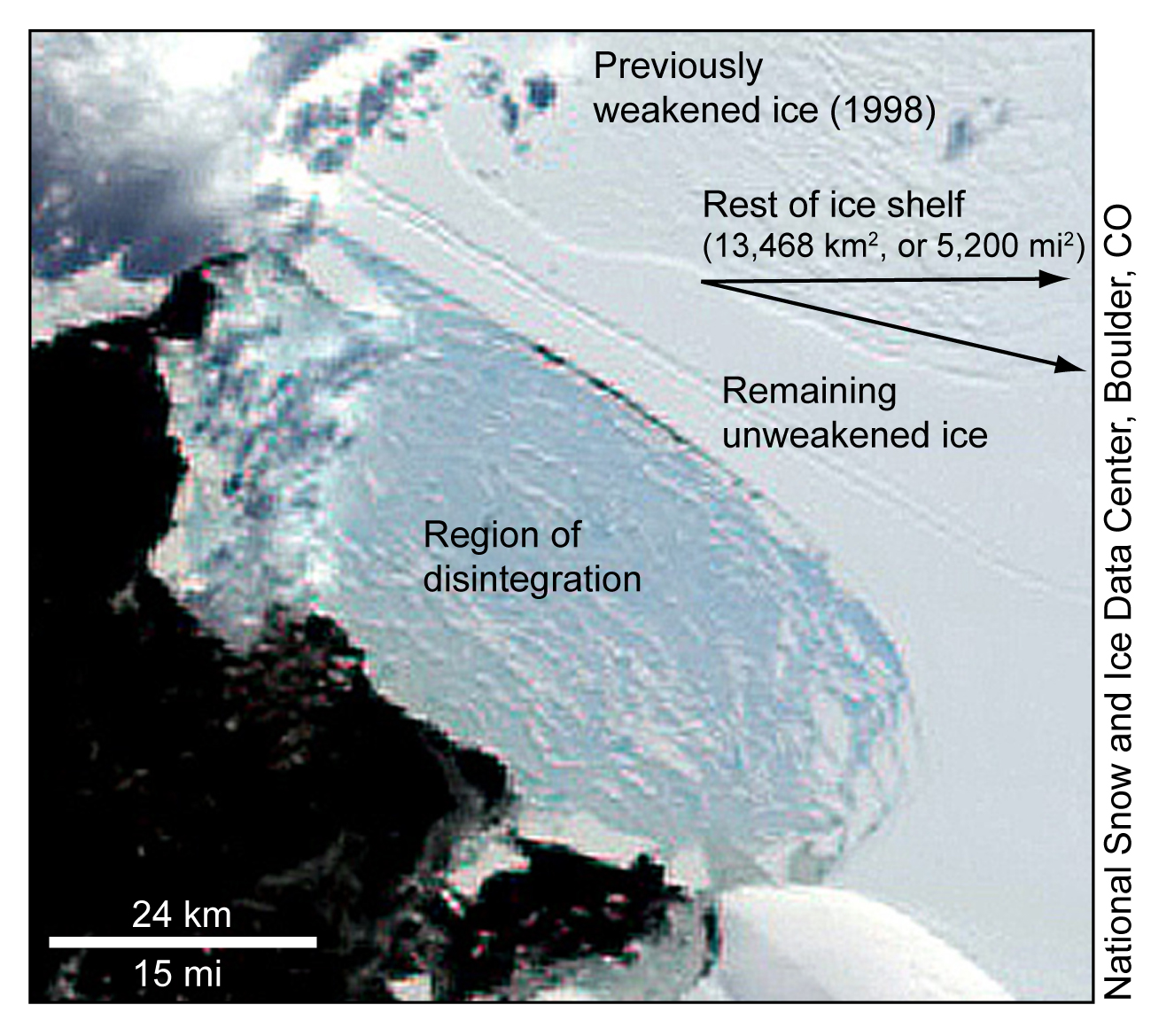
Satellite images indicate that the Wilkins began its
collapse on February 28; data revealed that a large iceberg, 41 by 2.5
kilometers (25.5 by 1.5 miles), fell away from the ice shelf's southwestern
front, triggering a runaway disintegration of 405 square kilometers (160
square miles) of the shelf interior (Figure 1). The edge of the shelf crumbled
into the sky-blue pattern of exposed deep glacial ice that has become characteristic
of climate-induced ice shelf break-ups such as the Larsen B in 2002. A
narrow beam of intact ice, just 6 kilometers wide (3.7 miles) was protecting
the remaining shelf from further breakup as of March 23 (Figure 2).
Scientists track ice shelves and study collapses carefully
because some of them hold back glaciers, which if unleashed, can accelerate
and raise sea level. Scambos said, "The Wilkins disintegration won't raise
sea level because it already floats in the ocean, and few glaciers flow
into it. However, the collapse underscores that the Wilkins region has
experienced an intense melt season. Regional sea ice has all but vanished,
leaving the ice shelf exposed to the action of waves."
With Antarctica's summer melt season drawing to a close,
scientists do not expect the Wilkins to further disintegrate in the next
several months. "This unusual show is over for this season," Scambos said.
"But come January, we'll be watching to see if the Wilkins continues to
fall apart."
Real-time collaboration
Images from NASA's Moderate Resolution Imaging Spectroradiometer
(MODIS) and data from ICESat showed that the ice shelf was in a state of
collapse in March. Scambos then alerted colleagues around the world, seeking
to ensure that every means of gathering information was focused on the
break-up.
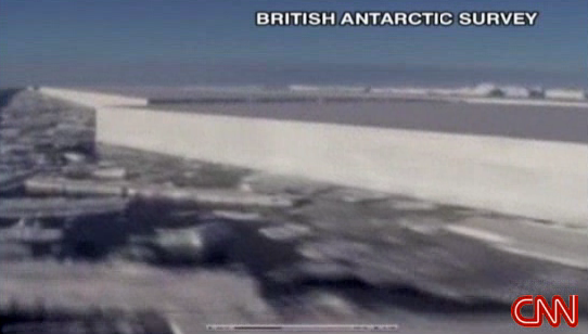
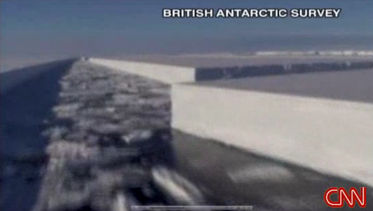
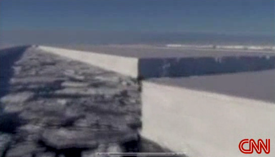
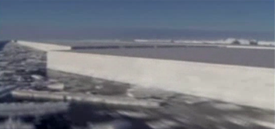
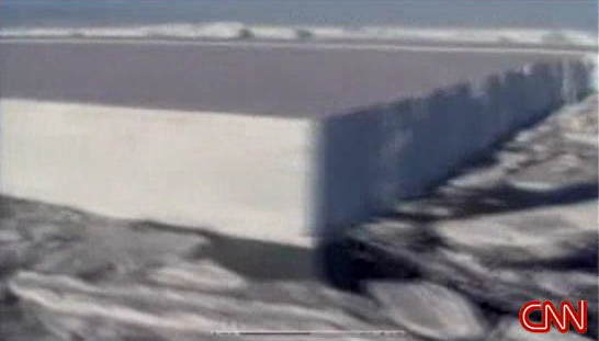
British Antarctic Survey (BAS) mounted an overflight
of the crumbling shelf, collecting video footage and other observations.
BAS glaciologist David Vaughan said of the ice shelf, which is supported
by a single strip of ice strung between two islands, "Wilkins is the largest
ice shelf on West Antarctica yet to be threatened. This shelf is hanging
by a thread."
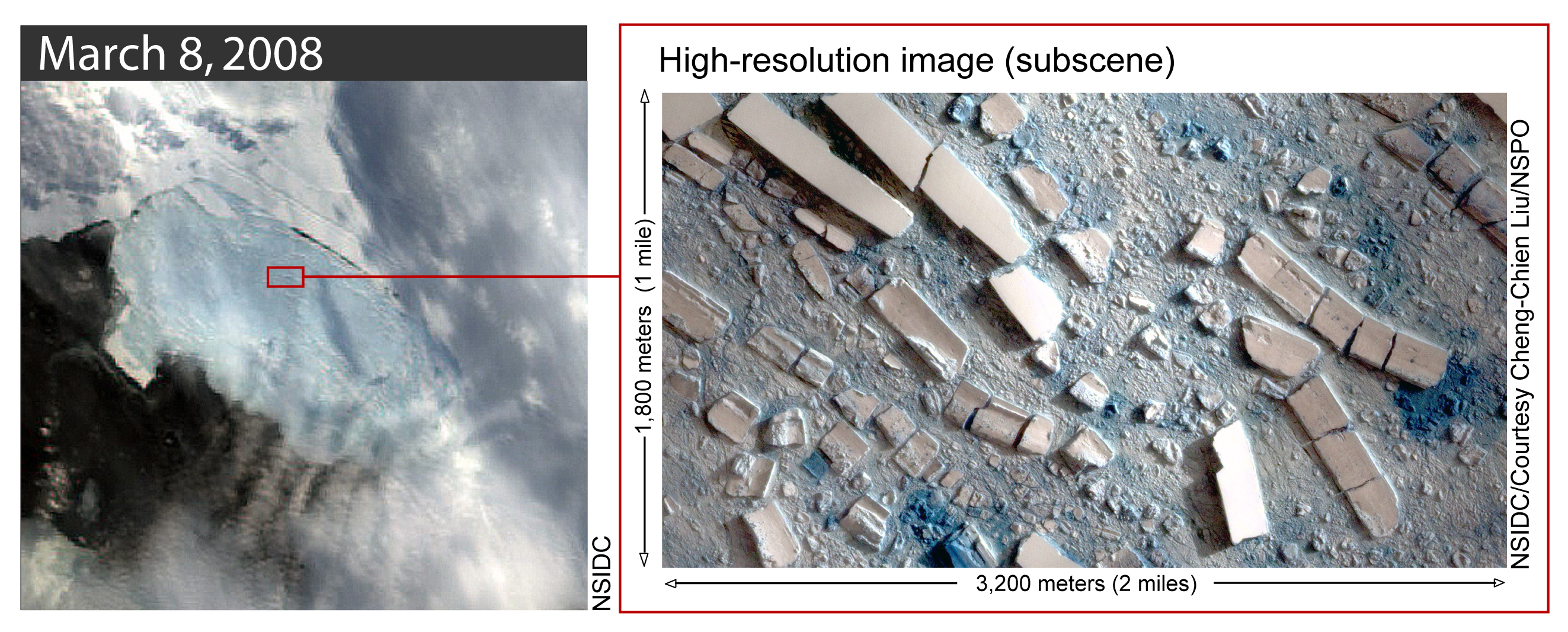
Associate Professor Cheng-Chien Liu at Taiwan's National
Cheng-Kung University (NCKU) also responded, requesting high-resolution
color satellite images of the area from Taiwan's Formosat-2 satellite (Figure
3), operated by the National Space Organization. Cheng-Chien Liu said,
"It looks as if something is slicing the ice shelf piece by piece on an
incredible scale, kilometers long but only a few hundred meters in width."
South American scientists also got involved. Andrés
Rivera and Gino Cassasa at the Laboratorio de Glaciología y Cambio
Climático at the Centro de Estudios Científicos in Chile
(CECS), acquired images of the Wilkins from the ASTER instrument, aboard
NASA's Terra satellite.
The combined efforts of these international teams have
begun to provide observational data that will improve scientific understanding
of the mechanisms behind ice shelf collapse. Scambos said, "The Wilkins
is an example of an event we don't see very often. But it's a key process
in being able to predict how sea level will change in the future."
More information
The Wilkins is one of a string of ice shelves that have
collapsed in the West Antarctic Peninsula in the past thirty years. The
Larsen B became the most well-known of these, disappearing in just over
thirty days in 2002. The Prince Gustav Channel, Larsen Inlet, Larsen
A, Wordie, Muller, and the Jones Ice Shelf collapses also underscore the
unprecedented warming in this region of Antarctica.
To view British Antarctic Survey's version of this
joint release, visit the press area of their Web site at http://www.antarctica.ac.uk/about_bas/news/press_releases.php
For more information on the Larsen B collapse, see
http://nsidc.org/iceshelves/larsenb2002/index.html.
Images and Movies
Credit: National Snow
and Ice Data Center
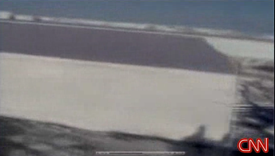
Figure 2. During the break-up,
the Wilkins Ice Shelf broke into a sky-blue pattern of exposed deep glacial
ice. This true-color image of the Wilkins Ice Shelf was taken by MODIS
on March 6, 2008. High-resolution
version
Credit: Left, National Snow and
Ice Data Center; right, National Snow and Ice Data Center/courtesy Cheng-Chien
Liu, National Cheng Kung University (NCKU), Taiwan and Taiwan's National
Space Organization (NSPO); processed at Earth Dynamic System Research Center
at NCKU, Taiwan.
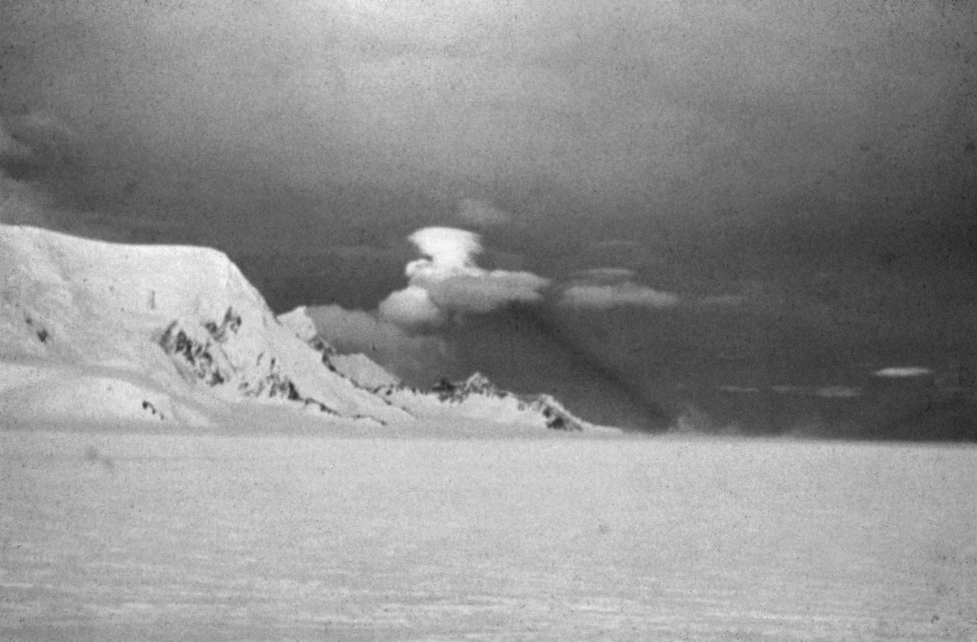
Figure 3. This image shows
a high-resolution, enhanced-color image of the Wilkins Ice Shelf in Antarctica
on March 8, 2008. Narrow iceberg blocks (150 meters wide, or 492 feet)
crumbled into house-sized rubble. Taiwan's Formosat-2 satellite acquired
this image. High-resolution version
Credit: National Snow and
Ice Data Center
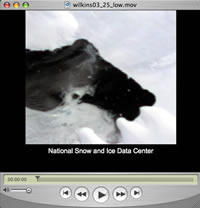
Figure 4. Click on the image
to show an animation
of the Wilkins disintegration (February 28—March 17).NSIDC processed these
images from the NASA Moderate Resolution Imaging Spectroradiometer (MODIS)
sensor, which flies on NASA's Earth Observing System Aqua and Terra satellites.
For a high-resolution version, please contact the press office.
|